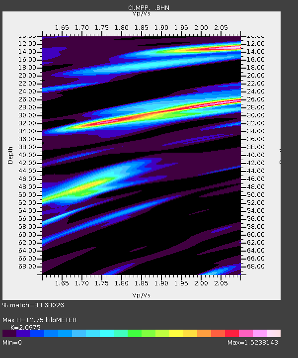
MPP McPhearson Peak - Earthquake Result Viewer
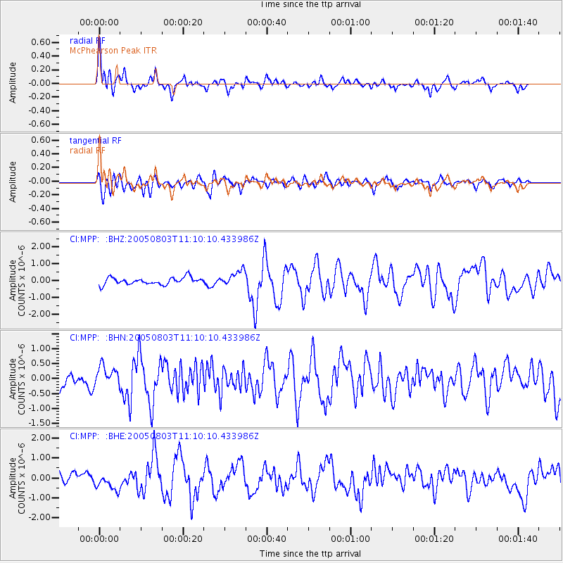
Earthquake location: Nicaragua
Earthquake latitude/longitude: 11.2/-85.5
Earthquake time(UTC): 2005/08/03 (215) 11:03:15 GMT
Earthquake Depth: 14 km
Earthquake Magnitude: 6.0 MB, 6.5 MS, 6.3 MW, 6.3 MW
Earthquake Catalog/Contributor: WHDF/NEIC
Network: CI Caltech Regional Seismic Network
Station: MPP McPhearson Peak
Lat/Lon: 34.89 N/119.81 W
Elevation: 1739 m
Distance: 39.0 deg
Az: 312.685 deg
Baz: 118.688 deg
Ray Param: 0.07520834
Estimated Moho Depth: 12.75 km
Estimated Crust Vp/Vs: 2.10
Assumed Crust Vp: 6.1 km/s
Estimated Crust Vs: 2.908 km/s
Estimated Crust Poisson's Ratio: 0.35
Radial Match: 83.68026 %
Radial Bump: 400
Transverse Match: 66.15924 %
Transverse Bump: 400
SOD ConfigId: 2475
Insert Time: 2010-02-26 02:03:53.159 +0000
GWidth: 2.5
Max Bumps: 400
Tol: 0.001

Signal To Noise

ChannelStoNSTALTA
CI:MPP: :BHN:20050803T11:10:10.433986Z1.29547263.2844233E-72.5353089E-7
CI:MPP: :BHE:20050803T11:10:10.433986Z1.76490124.354186E-72.467099E-7
CI:MPP: :BHZ:20050803T11:10:10.433986Z2.21412184.5977322E-72.0765488E-7
Arrivals
Ps2.4 SECOND
PpPs6.1 SECOND
PsPs/PpSs8.6 SECOND