
R20A Redvale, CO, USA - Earthquake Result Viewer
| ||||||||||||||||||
| ||||||||||||||||||
| ||||||||||||||||||
|
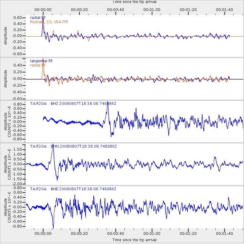
Signal To Noise
| Channel | StoN | STA | LTA |
| TA:R20A: :BHN:20080807T18:38:08.748986Z | 6.399801 | 3.7743962E-7 | 5.8976777E-8 |
| TA:R20A: :BHE:20080807T18:38:08.748986Z | 1.8594836 | 1.08848184E-7 | 5.853678E-8 |
| TA:R20A: :BHZ:20080807T18:38:08.748986Z | 2.0548003 | 1.5684381E-7 | 7.633044E-8 |
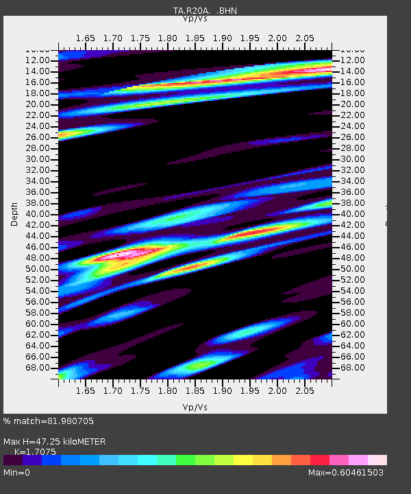
| Arrivals | |
| Ps | 5.6 SECOND |
| PpPs | 19 SECOND |
| PsPs/PpSs | 25 SECOND |

