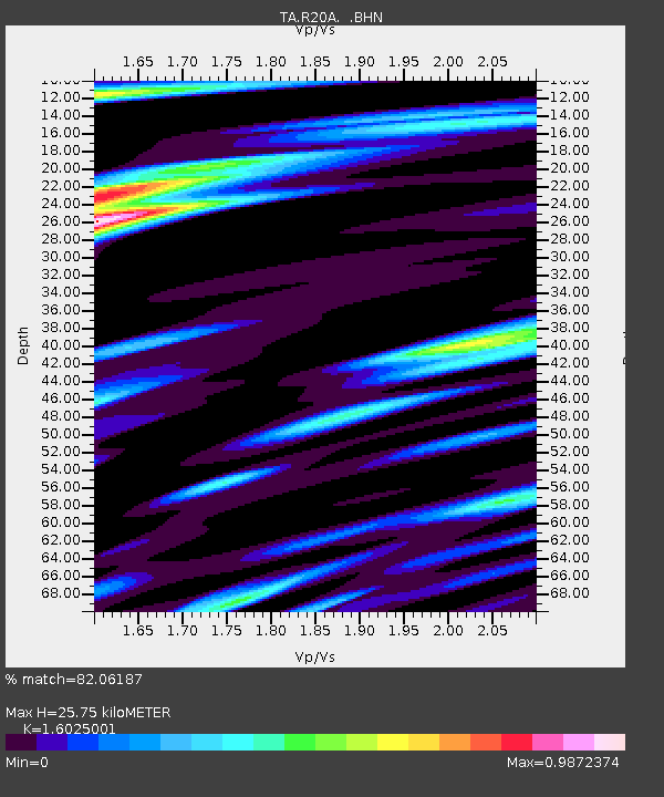
R20A Redvale, CO, USA - Earthquake Result Viewer
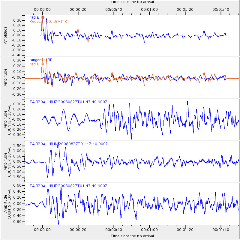
Earthquake location: Lake Baykal Region, Russia
Earthquake latitude/longitude: 51.6/104.2
Earthquake time(UTC): 2008/08/27 (240) 01:35:32 GMT
Earthquake Depth: 16 km
Earthquake Magnitude: 5.8 MB, 6.2 MS, 6.2 MW, 6.2 MW
Earthquake Catalog/Contributor: WHDF/NEIC
Network: TA USArray Transportable Network (new EarthScope stations)
Station: R20A Redvale, CO, USA
Lat/Lon: 38.19 N/108.38 W
Elevation: 2003 m
Distance: 86.2 deg
Az: 25.136 deg
Baz: 340.357 deg
Ray Param: 0.044241555
Estimated Moho Depth: 25.75 km
Estimated Crust Vp/Vs: 1.60
Assumed Crust Vp: 6.291 km/s
Estimated Crust Vs: 3.926 km/s
Estimated Crust Poisson's Ratio: 0.18
Radial Match: 82.06187 %
Radial Bump: 400
Transverse Match: 80.32962 %
Transverse Bump: 400
SOD ConfigId: 2504
Insert Time: 2010-03-06 12:25:53.025 +0000
GWidth: 2.5
Max Bumps: 400
Tol: 0.001

Signal To Noise

ChannelStoNSTALTA
TA:R20A: :BHN:20080827T01:47:40.900Z6.08441356.408299E-71.053232E-7
TA:R20A: :BHE:20080827T01:47:40.900Z3.8544662.2812164E-75.9183723E-8
TA:R20A: :BHZ:20080827T01:47:40.900Z0.99152448.5836454E-88.657018E-8
Arrivals
Ps2.5 SECOND
PpPs10 SECOND
PsPs/PpSs13 SECOND