You are here: Home > Network List > TA - USArray Transportable Network (new EarthScope stations) Stations List
> Station MDND Maddock, ND, USA > Earthquake Result Viewer
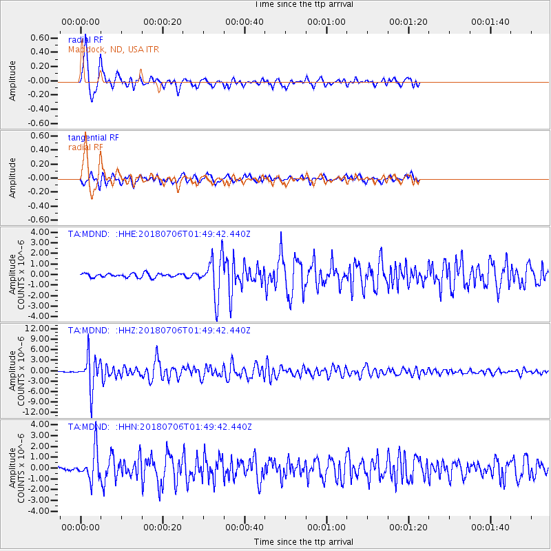
MDND Maddock, ND, USA - Earthquake Result Viewer
*The percent match for this event was below the threshold and hence no stack was calculated.
| Earthquake location: |
Near East Coast Of Kamchatka |
| Earthquake latitude/longitude: |
51.6/157.9 |
| Earthquake time(UTC): |
2018/07/06 (187) 01:40:08 GMT |
| Earthquake Depth: |
80 km |
| Earthquake Magnitude: |
6.1 Mwp |
| Earthquake Catalog/Contributor: |
NEIC PDE/us |
|
| Network: |
TA USArray Transportable Network (new EarthScope stations) |
| Station: |
MDND Maddock, ND, USA |
| Lat/Lon: |
47.85 N/99.60 W |
| Elevation: |
479 m |
|
| Distance: |
60.9 deg |
| Az: |
48.818 deg |
| Baz: |
315.836 deg |
| Ray Param: |
$rayparam |
*The percent match for this event was below the threshold and hence was not used in the summary stack. |
|
| Radial Match: |
94.00384 % |
| Radial Bump: |
400 |
| Transverse Match: |
75.023834 % |
| Transverse Bump: |
400 |
| SOD ConfigId: |
13570011 |
| Insert Time: |
2019-04-30 12:43:00.396 +0000 |
| GWidth: |
2.5 |
| Max Bumps: |
400 |
| Tol: |
0.001 |
|
Signal To Noise
| Channel | StoN | STA | LTA |
| TA:MDND: :HHZ:20180706T01:49:42.440Z | 36.268436 | 4.84034E-6 | 1.3345874E-7 |
| TA:MDND: :HHN:20180706T01:49:42.440Z | 6.8909674 | 1.4645107E-6 | 2.1252615E-7 |
| TA:MDND: :HHE:20180706T01:49:42.440Z | 9.654026 | 1.793313E-6 | 1.8575805E-7 |
| Arrivals |
| Ps | |
| PpPs | |
| PsPs/PpSs | |


