
R20A Redvale, CO, USA - Earthquake Result Viewer
| ||||||||||||||||||
| ||||||||||||||||||
| ||||||||||||||||||
|
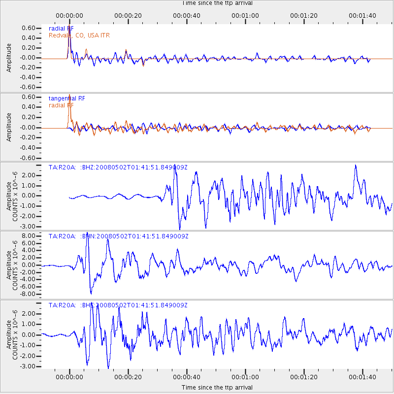
Signal To Noise
| Channel | StoN | STA | LTA |
| TA:R20A: :BHN:20080502T01:41:51.849009Z | 8.83983 | 1.2653828E-6 | 1.4314561E-7 |
| TA:R20A: :BHE:20080502T01:41:51.849009Z | 4.368515 | 3.9275994E-7 | 8.990697E-8 |
| TA:R20A: :BHZ:20080502T01:41:51.849009Z | 3.7533128 | 4.9557576E-7 | 1.3203689E-7 |
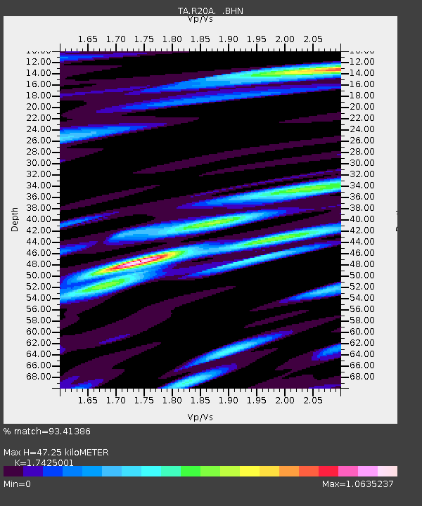
| Arrivals | |
| Ps | 5.9 SECOND |
| PpPs | 19 SECOND |
| PsPs/PpSs | 25 SECOND |

