You are here: Home > Network List > TA - USArray Transportable Network (new EarthScope stations) Stations List
> Station R20A Redvale, CO, USA > Earthquake Result Viewer
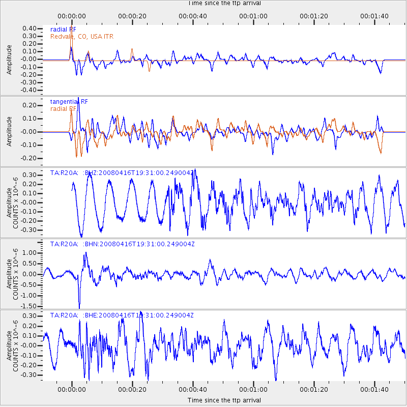
R20A Redvale, CO, USA - Earthquake Result Viewer
*The percent match for this event was below the threshold and hence no stack was calculated.
| Earthquake location: |
Eastern Honshu, Japan |
| Earthquake latitude/longitude: |
39.0/140.0 |
| Earthquake time(UTC): |
2008/04/16 (107) 19:19:36 GMT |
| Earthquake Depth: |
166 km |
| Earthquake Magnitude: |
5.6 MB, 5.8 MW, 5.8 MW |
| Earthquake Catalog/Contributor: |
WHDF/NEIC |
|
| Network: |
TA USArray Transportable Network (new EarthScope stations) |
| Station: |
R20A Redvale, CO, USA |
| Lat/Lon: |
38.19 N/108.38 W |
| Elevation: |
2003 m |
|
| Distance: |
80.8 deg |
| Az: |
47.914 deg |
| Baz: |
312.813 deg |
| Ray Param: |
$rayparam |
*The percent match for this event was below the threshold and hence was not used in the summary stack. |
|
| Radial Match: |
57.177315 % |
| Radial Bump: |
400 |
| Transverse Match: |
55.55415 % |
| Transverse Bump: |
400 |
| SOD ConfigId: |
2504 |
| Insert Time: |
2010-03-06 12:27:44.005 +0000 |
| GWidth: |
2.5 |
| Max Bumps: |
400 |
| Tol: |
0.001 |
|
Signal To Noise
| Channel | StoN | STA | LTA |
| TA:R20A: :BHN:20080416T19:31:00.249004Z | 3.8713944 | 5.583555E-7 | 1.4422594E-7 |
| TA:R20A: :BHE:20080416T19:31:00.249004Z | 1.2629524 | 1.2207204E-7 | 9.665609E-8 |
| TA:R20A: :BHZ:20080416T19:31:00.249004Z | 0.78386986 | 1.5055177E-7 | 1.920622E-7 |
| Arrivals |
| Ps | |
| PpPs | |
| PsPs/PpSs | |


