You are here: Home > Network List > TA - USArray Transportable Network (new EarthScope stations) Stations List
> Station R20A Redvale, CO, USA > Earthquake Result Viewer
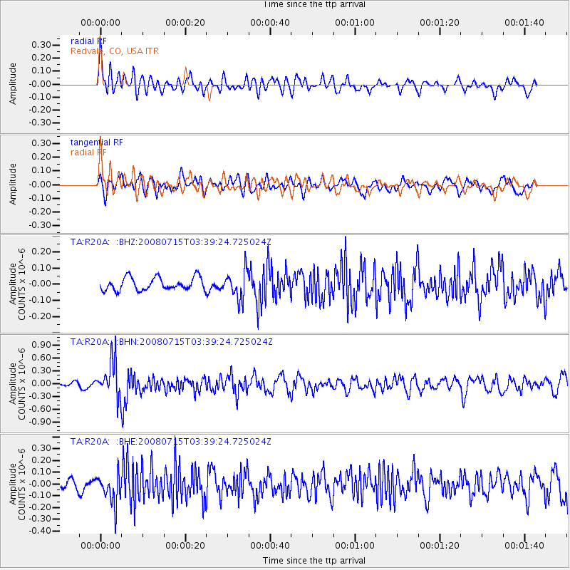
R20A Redvale, CO, USA - Earthquake Result Viewer
*The percent match for this event was below the threshold and hence no stack was calculated.
| Earthquake location: |
Dodecanese Islands, Greece |
| Earthquake latitude/longitude: |
35.8/27.9 |
| Earthquake time(UTC): |
2008/07/15 (197) 03:26:34 GMT |
| Earthquake Depth: |
52 km |
| Earthquake Magnitude: |
6.5 MB, 6.4 MW, 6.4 MW |
| Earthquake Catalog/Contributor: |
WHDF/NEIC |
|
| Network: |
TA USArray Transportable Network (new EarthScope stations) |
| Station: |
R20A Redvale, CO, USA |
| Lat/Lon: |
38.19 N/108.38 W |
| Elevation: |
2003 m |
|
| Distance: |
96.0 deg |
| Az: |
326.771 deg |
| Baz: |
34.425 deg |
| Ray Param: |
$rayparam |
*The percent match for this event was below the threshold and hence was not used in the summary stack. |
|
| Radial Match: |
72.71584 % |
| Radial Bump: |
400 |
| Transverse Match: |
64.69042 % |
| Transverse Bump: |
400 |
| SOD ConfigId: |
2504 |
| Insert Time: |
2010-03-06 12:28:02.009 +0000 |
| GWidth: |
2.5 |
| Max Bumps: |
400 |
| Tol: |
0.001 |
|
Signal To Noise
| Channel | StoN | STA | LTA |
| TA:R20A: :BHN:20080715T03:39:24.725024Z | 8.479975 | 4.4059485E-7 | 5.1957095E-8 |
| TA:R20A: :BHE:20080715T03:39:24.725024Z | 2.3170335 | 1.2937448E-7 | 5.583626E-8 |
| TA:R20A: :BHZ:20080715T03:39:24.725024Z | 2.2130105 | 8.779381E-8 | 3.967166E-8 |
| Arrivals |
| Ps | |
| PpPs | |
| PsPs/PpSs | |


