You are here: Home > Network List > CN - Canadian National Seismograph Network Stations List
> Station INK INUVIK, NT > Earthquake Result Viewer
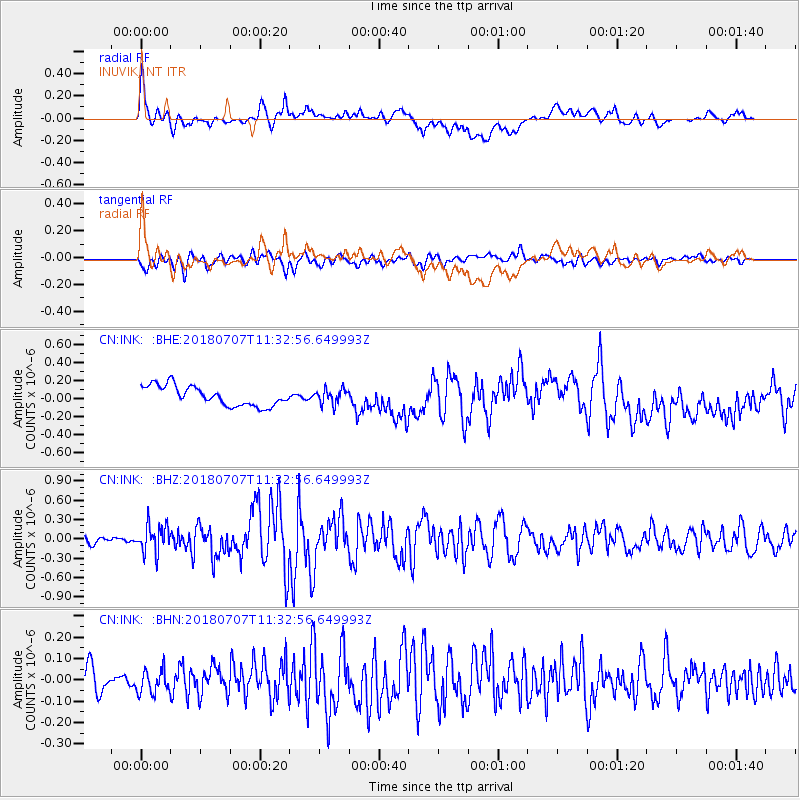
INK INUVIK, NT - Earthquake Result Viewer
*The percent match for this event was below the threshold and hence no stack was calculated.
| Earthquake location: |
Near East Coast Of Honshu, Japan |
| Earthquake latitude/longitude: |
35.1/140.7 |
| Earthquake time(UTC): |
2018/07/07 (188) 11:23:49 GMT |
| Earthquake Depth: |
39 km |
| Earthquake Magnitude: |
5.9 Mww |
| Earthquake Catalog/Contributor: |
NEIC PDE/us |
|
| Network: |
CN Canadian National Seismograph Network |
| Station: |
INK INUVIK, NT |
| Lat/Lon: |
68.31 N/133.53 W |
| Elevation: |
44 m |
|
| Distance: |
56.4 deg |
| Az: |
26.437 deg |
| Baz: |
280.886 deg |
| Ray Param: |
$rayparam |
*The percent match for this event was below the threshold and hence was not used in the summary stack. |
|
| Radial Match: |
60.269066 % |
| Radial Bump: |
400 |
| Transverse Match: |
67.917984 % |
| Transverse Bump: |
400 |
| SOD ConfigId: |
13570011 |
| Insert Time: |
2019-04-30 12:51:46.472 +0000 |
| GWidth: |
2.5 |
| Max Bumps: |
400 |
| Tol: |
0.001 |
|
Signal To Noise
| Channel | StoN | STA | LTA |
| CN:INK: :BHZ:20180707T11:32:56.649993Z | 2.907248 | 2.1412826E-7 | 7.3653254E-8 |
| CN:INK: :BHN:20180707T11:32:56.649993Z | 1.0077246 | 5.305282E-8 | 5.2646143E-8 |
| CN:INK: :BHE:20180707T11:32:56.649993Z | 0.7483147 | 8.198994E-8 | 1.0956613E-7 |
| Arrivals |
| Ps | |
| PpPs | |
| PsPs/PpSs | |


