You are here: Home > Network List > TA - USArray Transportable Network (new EarthScope stations) Stations List
> Station R20A Redvale, CO, USA > Earthquake Result Viewer
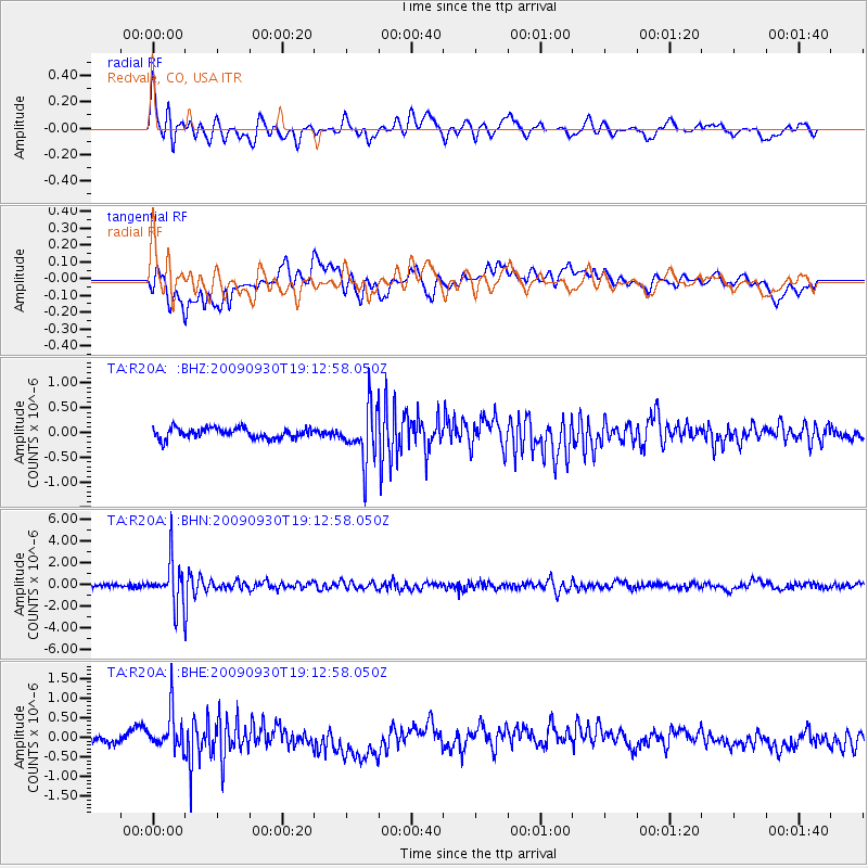
R20A Redvale, CO, USA - Earthquake Result Viewer
*The percent match for this event was below the threshold and hence no stack was calculated.
| Earthquake location: |
Peru-Bolivia Border Region |
| Earthquake latitude/longitude: |
-15.6/-69.3 |
| Earthquake time(UTC): |
2009/09/30 (273) 19:03:17 GMT |
| Earthquake Depth: |
255 km |
| Earthquake Magnitude: |
5.9 MB, 5.8 MW |
| Earthquake Catalog/Contributor: |
WHDF/NEIC |
|
| Network: |
TA USArray Transportable Network (new EarthScope stations) |
| Station: |
R20A Redvale, CO, USA |
| Lat/Lon: |
38.19 N/108.38 W |
| Elevation: |
2003 m |
|
| Distance: |
64.8 deg |
| Az: |
326.702 deg |
| Baz: |
137.816 deg |
| Ray Param: |
$rayparam |
*The percent match for this event was below the threshold and hence was not used in the summary stack. |
|
| Radial Match: |
69.010704 % |
| Radial Bump: |
400 |
| Transverse Match: |
52.815617 % |
| Transverse Bump: |
400 |
| SOD ConfigId: |
2622 |
| Insert Time: |
2010-03-06 12:28:23.512 +0000 |
| GWidth: |
2.5 |
| Max Bumps: |
400 |
| Tol: |
0.001 |
|
Signal To Noise
| Channel | StoN | STA | LTA |
| TA:R20A: :BHN:20090930T19:12:58.050Z | 13.970525 | 2.0410116E-6 | 1.4609412E-7 |
| TA:R20A: :BHE:20090930T19:12:58.050Z | 3.6453695 | 5.026358E-7 | 1.3788336E-7 |
| TA:R20A: :BHZ:20090930T19:12:58.050Z | 5.1558 | 5.303119E-7 | 1.0285735E-7 |
| Arrivals |
| Ps | |
| PpPs | |
| PsPs/PpSs | |


