You are here: Home > Network List > TA - USArray Transportable Network (new EarthScope stations) Stations List
> Station R20A Redvale, CO, USA > Earthquake Result Viewer
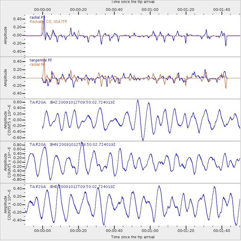
R20A Redvale, CO, USA - Earthquake Result Viewer
*The percent match for this event was below the threshold and hence no stack was calculated.
| Earthquake location: |
Santa Cruz Islands |
| Earthquake latitude/longitude: |
-12.4/166.5 |
| Earthquake time(UTC): |
2009/10/12 (285) 09:37:21 GMT |
| Earthquake Depth: |
42 km |
| Earthquake Magnitude: |
5.9 MB, 5.9 MS, 6.2 MW, 6.2 MW |
| Earthquake Catalog/Contributor: |
WHDF/NEIC |
|
| Network: |
TA USArray Transportable Network (new EarthScope stations) |
| Station: |
R20A Redvale, CO, USA |
| Lat/Lon: |
38.19 N/108.38 W |
| Elevation: |
2003 m |
|
| Distance: |
93.8 deg |
| Az: |
51.893 deg |
| Baz: |
257.295 deg |
| Ray Param: |
$rayparam |
*The percent match for this event was below the threshold and hence was not used in the summary stack. |
|
| Radial Match: |
70.13105 % |
| Radial Bump: |
313 |
| Transverse Match: |
63.975212 % |
| Transverse Bump: |
400 |
| SOD ConfigId: |
2622 |
| Insert Time: |
2010-03-06 12:28:28.404 +0000 |
| GWidth: |
2.5 |
| Max Bumps: |
400 |
| Tol: |
0.001 |
|
Signal To Noise
| Channel | StoN | STA | LTA |
| TA:R20A: :BHN:20091012T09:50:02.724019Z | 1.9776628 | 5.458203E-7 | 2.759926E-7 |
| TA:R20A: :BHE:20091012T09:50:02.724019Z | 1.9410696 | 2.4823203E-7 | 1.2788415E-7 |
| TA:R20A: :BHZ:20091012T09:50:02.724019Z | 1.4458344 | 2.6553732E-7 | 1.8365681E-7 |
| Arrivals |
| Ps | |
| PpPs | |
| PsPs/PpSs | |


