You are here: Home > Network List > TA - USArray Transportable Network (new EarthScope stations) Stations List
> Station R20A Redvale, CO, USA > Earthquake Result Viewer
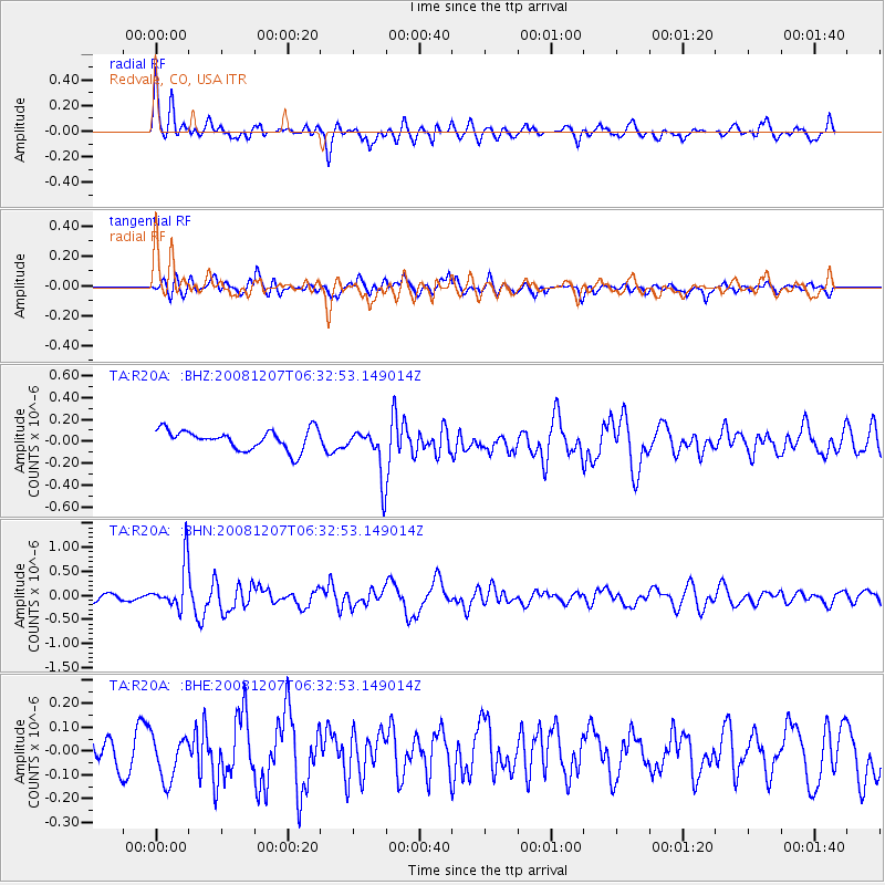
R20A Redvale, CO, USA - Earthquake Result Viewer
*The percent match for this event was below the threshold and hence no stack was calculated.
| Earthquake location: |
Northern Mid-Atlantic Ridge |
| Earthquake latitude/longitude: |
13.4/-44.8 |
| Earthquake time(UTC): |
2008/12/07 (342) 06:23:09 GMT |
| Earthquake Depth: |
10 km |
| Earthquake Magnitude: |
5.6 MB, 5.3 MS, 5.7 MW |
| Earthquake Catalog/Contributor: |
WHDF/NEIC |
|
| Network: |
TA USArray Transportable Network (new EarthScope stations) |
| Station: |
R20A Redvale, CO, USA |
| Lat/Lon: |
38.19 N/108.38 W |
| Elevation: |
2003 m |
|
| Distance: |
61.1 deg |
| Az: |
306.326 deg |
| Baz: |
95.642 deg |
| Ray Param: |
$rayparam |
*The percent match for this event was below the threshold and hence was not used in the summary stack. |
|
| Radial Match: |
68.14804 % |
| Radial Bump: |
400 |
| Transverse Match: |
39.27255 % |
| Transverse Bump: |
400 |
| SOD ConfigId: |
2658 |
| Insert Time: |
2010-03-06 12:28:40.026 +0000 |
| GWidth: |
2.5 |
| Max Bumps: |
400 |
| Tol: |
0.001 |
|
Signal To Noise
| Channel | StoN | STA | LTA |
| TA:R20A: :BHN:20081207T06:32:53.149014Z | 4.010359 | 4.705729E-7 | 1.17339354E-7 |
| TA:R20A: :BHE:20081207T06:32:53.149014Z | 0.9166849 | 9.143261E-8 | 9.9742685E-8 |
| TA:R20A: :BHZ:20081207T06:32:53.149014Z | 2.4807503 | 2.2451057E-7 | 9.0501075E-8 |
| Arrivals |
| Ps | |
| PpPs | |
| PsPs/PpSs | |


