You are here: Home > Network List > TA - USArray Transportable Network (new EarthScope stations) Stations List
> Station R20A Redvale, CO, USA > Earthquake Result Viewer
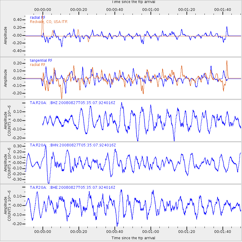
R20A Redvale, CO, USA - Earthquake Result Viewer
*The percent match for this event was below the threshold and hence no stack was calculated.
| Earthquake location: |
Kuril Islands |
| Earthquake latitude/longitude: |
46.7/152.5 |
| Earthquake time(UTC): |
2008/08/27 (240) 05:24:41 GMT |
| Earthquake Depth: |
65 km |
| Earthquake Magnitude: |
5.5 MB, 5.4 MW, 5.3 MW |
| Earthquake Catalog/Contributor: |
WHDF/NEIC |
|
| Network: |
TA USArray Transportable Network (new EarthScope stations) |
| Station: |
R20A Redvale, CO, USA |
| Lat/Lon: |
38.19 N/108.38 W |
| Elevation: |
2003 m |
|
| Distance: |
68.9 deg |
| Az: |
56.529 deg |
| Baz: |
313.26 deg |
| Ray Param: |
$rayparam |
*The percent match for this event was below the threshold and hence was not used in the summary stack. |
|
| Radial Match: |
56.672977 % |
| Radial Bump: |
400 |
| Transverse Match: |
62.95127 % |
| Transverse Bump: |
400 |
| SOD ConfigId: |
2504 |
| Insert Time: |
2010-03-06 12:29:08.000 +0000 |
| GWidth: |
2.5 |
| Max Bumps: |
400 |
| Tol: |
0.001 |
|
Signal To Noise
| Channel | StoN | STA | LTA |
| TA:R20A: :BHN:20080827T05:35:07.924016Z | 1.9337122 | 2.1070156E-7 | 1.08962205E-7 |
| TA:R20A: :BHE:20080827T05:35:07.924016Z | 1.4265498 | 6.249387E-8 | 4.38077E-8 |
| TA:R20A: :BHZ:20080827T05:35:07.924016Z | 0.97004896 | 5.6830796E-8 | 5.8585496E-8 |
| Arrivals |
| Ps | |
| PpPs | |
| PsPs/PpSs | |


