You are here: Home > Network List > CI - Caltech Regional Seismic Network Stations List
> Station MPP McPhearson Peak > Earthquake Result Viewer
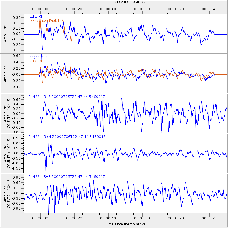
MPP McPhearson Peak - Earthquake Result Viewer
*The percent match for this event was below the threshold and hence no stack was calculated.
| Earthquake location: |
Southeast Of Ryukyu Islands |
| Earthquake latitude/longitude: |
24.9/128.0 |
| Earthquake time(UTC): |
2009/07/06 (187) 22:35:05 GMT |
| Earthquake Depth: |
10 km |
| Earthquake Magnitude: |
6.1 MB, 5.3 MS, 5.7 MW, 5.7 MW |
| Earthquake Catalog/Contributor: |
WHDF/NEIC |
|
| Network: |
CI Caltech Regional Seismic Network |
| Station: |
MPP McPhearson Peak |
| Lat/Lon: |
34.89 N/119.81 W |
| Elevation: |
1739 m |
|
| Distance: |
92.5 deg |
| Az: |
49.647 deg |
| Baz: |
302.647 deg |
| Ray Param: |
$rayparam |
*The percent match for this event was below the threshold and hence was not used in the summary stack. |
|
| Radial Match: |
67.53864 % |
| Radial Bump: |
400 |
| Transverse Match: |
65.96649 % |
| Transverse Bump: |
400 |
| SOD ConfigId: |
2648 |
| Insert Time: |
2010-02-26 02:04:19.380 +0000 |
| GWidth: |
2.5 |
| Max Bumps: |
400 |
| Tol: |
0.001 |
|
Signal To Noise
| Channel | StoN | STA | LTA |
| CI:MPP: :BHN:20090706T22:47:44.546001Z | 4.9096527 | 7.826472E-7 | 1.594099E-7 |
| CI:MPP: :BHE:20090706T22:47:44.546001Z | 1.441469 | 3.3713582E-7 | 2.3388351E-7 |
| CI:MPP: :BHZ:20090706T22:47:44.546001Z | 1.3894788 | 2.6563177E-7 | 1.9117367E-7 |
| Arrivals |
| Ps | |
| PpPs | |
| PsPs/PpSs | |


