You are here: Home > Network List > CI - Caltech Regional Seismic Network Stations List
> Station MPP McPhearson Peak > Earthquake Result Viewer
MPP McPhearson Peak - Earthquake Result Viewer
*The percent match for this event was below the threshold and hence no stack was calculated.
| Earthquake location: |
Northwest Of Ryukyu Islands |
| Earthquake latitude/longitude: |
27.4/126.7 |
| Earthquake time(UTC): |
2009/03/26 (085) 19:19:59 GMT |
| Earthquake Depth: |
160 km |
| Earthquake Magnitude: |
5.6 MB, 5.9 MW, 5.9 MW |
| Earthquake Catalog/Contributor: |
WHDF/NEIC |
|
| Network: |
CI Caltech Regional Seismic Network |
| Station: |
MPP McPhearson Peak |
| Lat/Lon: |
34.89 N/119.81 W |
| Elevation: |
1739 m |
|
| Distance: |
91.7 deg |
| Az: |
48.966 deg |
| Baz: |
305.344 deg |
| Ray Param: |
$rayparam |
*The percent match for this event was below the threshold and hence was not used in the summary stack. |
|
| Radial Match: |
53.8812 % |
| Radial Bump: |
400 |
| Transverse Match: |
50.91512 % |
| Transverse Bump: |
400 |
| SOD ConfigId: |
2658 |
| Insert Time: |
2010-02-26 02:04:19.999 +0000 |
| GWidth: |
2.5 |
| Max Bumps: |
400 |
| Tol: |
0.001 |
|
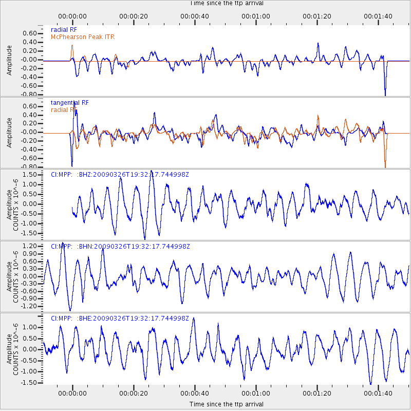
Signal To Noise
| Channel | StoN | STA | LTA |
| CI:MPP: :BHN:20090326T19:32:17.744998Z | 1.777781 | 6.69232E-7 | 3.764423E-7 |
| CI:MPP: :BHE:20090326T19:32:17.744998Z | 1.1812943 | 9.1710575E-7 | 7.7635667E-7 |
| CI:MPP: :BHZ:20090326T19:32:17.744998Z | 0.8301095 | 5.6081467E-7 | 6.7559125E-7 |
| Arrivals |
| Ps | |
| PpPs | |
| PsPs/PpSs | |


