
W21A San Fidel, NM, USA - Earthquake Result Viewer
| ||||||||||||||||||
| ||||||||||||||||||
| ||||||||||||||||||
|
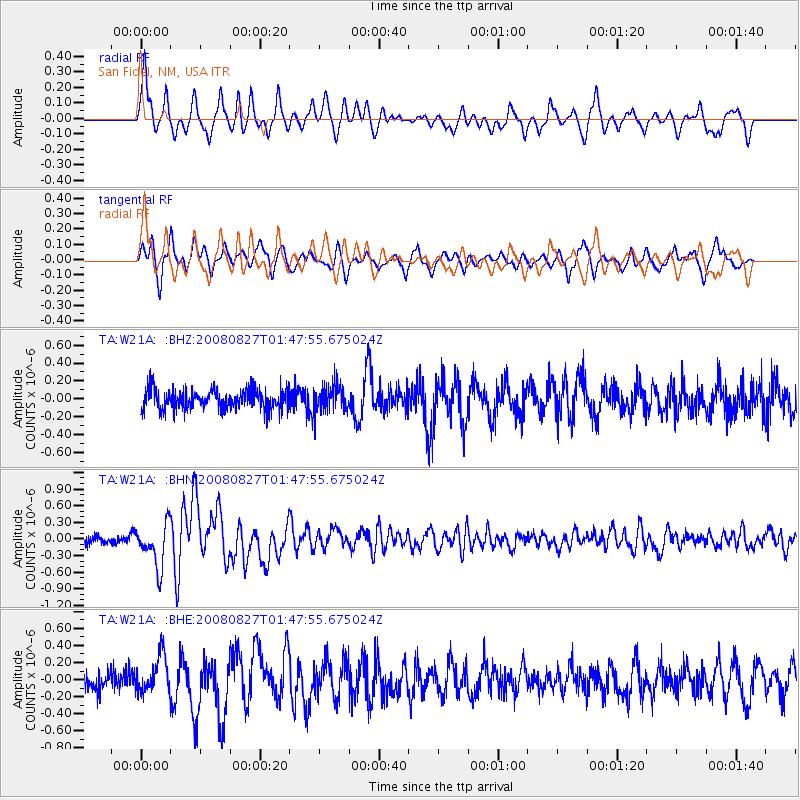
Signal To Noise
| Channel | StoN | STA | LTA |
| TA:W21A: :BHN:20080827T01:47:55.675024Z | 5.1838593 | 3.8971982E-7 | 7.517947E-8 |
| TA:W21A: :BHE:20080827T01:47:55.675024Z | 2.051385 | 2.1964595E-7 | 1.0707203E-7 |
| TA:W21A: :BHZ:20080827T01:47:55.675024Z | 1.3122377 | 1.4905315E-7 | 1.13587E-7 |
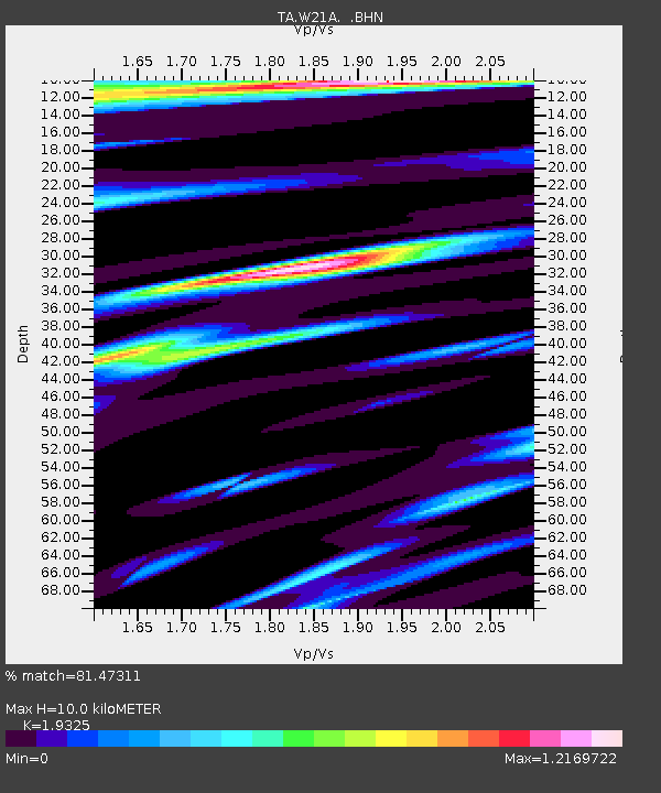
| Arrivals | |
| Ps | 1.5 SECOND |
| PpPs | 4.4 SECOND |
| PsPs/PpSs | 5.9 SECOND |

