You are here: Home > Network List > CI - Caltech Regional Seismic Network Stations List
> Station MPP McPhearson Peak > Earthquake Result Viewer
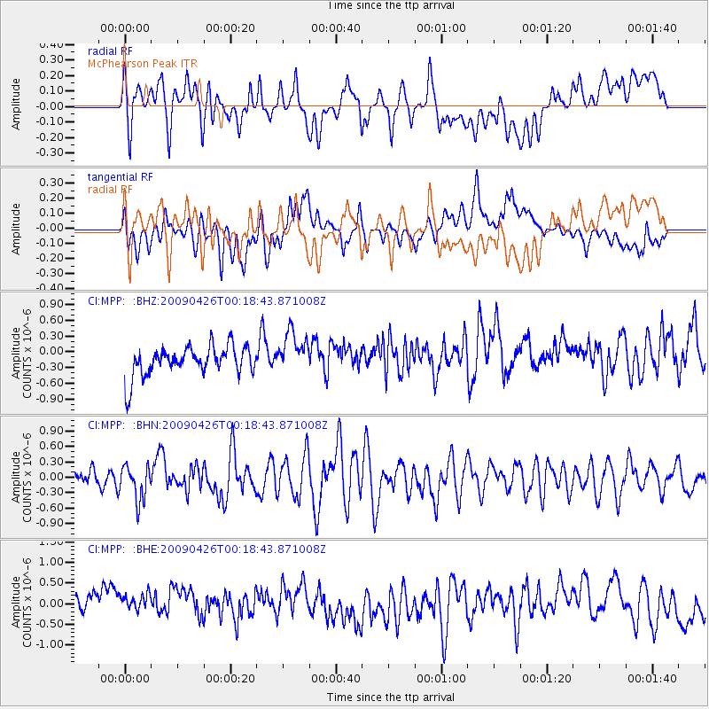
MPP McPhearson Peak - Earthquake Result Viewer
*The percent match for this event was below the threshold and hence no stack was calculated.
| Earthquake location: |
Kermadec Islands, New Zealand |
| Earthquake latitude/longitude: |
-30.3/-178.6 |
| Earthquake time(UTC): |
2009/04/26 (116) 00:06:53 GMT |
| Earthquake Depth: |
132 km |
| Earthquake Magnitude: |
5.5 MB, 6.1 MW, 6.1 MW |
| Earthquake Catalog/Contributor: |
WHDF/NEIC |
|
| Network: |
CI Caltech Regional Seismic Network |
| Station: |
MPP McPhearson Peak |
| Lat/Lon: |
34.89 N/119.81 W |
| Elevation: |
1739 m |
|
| Distance: |
85.3 deg |
| Az: |
44.858 deg |
| Baz: |
227.909 deg |
| Ray Param: |
$rayparam |
*The percent match for this event was below the threshold and hence was not used in the summary stack. |
|
| Radial Match: |
50.165134 % |
| Radial Bump: |
400 |
| Transverse Match: |
49.088837 % |
| Transverse Bump: |
400 |
| SOD ConfigId: |
2658 |
| Insert Time: |
2010-02-26 02:04:20.925 +0000 |
| GWidth: |
2.5 |
| Max Bumps: |
400 |
| Tol: |
0.001 |
|
Signal To Noise
| Channel | StoN | STA | LTA |
| CI:MPP: :BHN:20090426T00:18:43.871008Z | 2.2300353 | 3.4152092E-7 | 1.5314598E-7 |
| CI:MPP: :BHE:20090426T00:18:43.871008Z | 1.3355297 | 4.739993E-7 | 3.5491485E-7 |
| CI:MPP: :BHZ:20090426T00:18:43.871008Z | 1.4464543 | 4.0832182E-7 | 2.8229155E-7 |
| Arrivals |
| Ps | |
| PpPs | |
| PsPs/PpSs | |


