You are here: Home > Network List > US - United States National Seismic Network Stations List
> Station DGMT Dagmar, Montana, USA > Earthquake Result Viewer
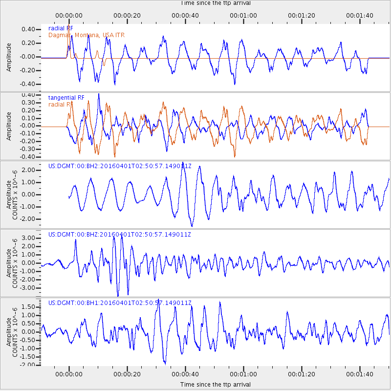
DGMT Dagmar, Montana, USA - Earthquake Result Viewer
*The percent match for this event was below the threshold and hence no stack was calculated.
| Earthquake location: |
Near S. Coast Of Western Honshu |
| Earthquake latitude/longitude: |
33.4/136.4 |
| Earthquake time(UTC): |
2016/04/01 (092) 02:39:07 GMT |
| Earthquake Depth: |
10 km |
| Earthquake Magnitude: |
6.0 MWP |
| Earthquake Catalog/Contributor: |
NEIC PDE/NEIC COMCAT |
|
| Network: |
US United States National Seismic Network |
| Station: |
DGMT Dagmar, Montana, USA |
| Lat/Lon: |
48.47 N/104.20 W |
| Elevation: |
0.0 m |
|
| Distance: |
82.2 deg |
| Az: |
35.819 deg |
| Baz: |
312.62 deg |
| Ray Param: |
$rayparam |
*The percent match for this event was below the threshold and hence was not used in the summary stack. |
|
| Radial Match: |
60.8701 % |
| Radial Bump: |
400 |
| Transverse Match: |
56.345955 % |
| Transverse Bump: |
400 |
| SOD ConfigId: |
1609551 |
| Insert Time: |
2016-06-22 14:36:33.065 +0000 |
| GWidth: |
2.5 |
| Max Bumps: |
400 |
| Tol: |
0.001 |
|
Signal To Noise
| Channel | StoN | STA | LTA |
| US:DGMT:00:BHZ:20160401T02:50:57.149011Z | 5.201315 | 1.1145411E-6 | 2.1428063E-7 |
| US:DGMT:00:BH1:20160401T02:50:57.149011Z | 0.9330031 | 3.656522E-7 | 3.9190886E-7 |
| US:DGMT:00:BH2:20160401T02:50:57.149011Z | 0.87507933 | 7.1628847E-7 | 8.1854114E-7 |
| Arrivals |
| Ps | |
| PpPs | |
| PsPs/PpSs | |


