You are here: Home > Network List > TA - USArray Transportable Network (new EarthScope stations) Stations List
> Station W21A San Fidel, NM, USA > Earthquake Result Viewer
W21A San Fidel, NM, USA - Earthquake Result Viewer

| Earthquake location: |
Hokkaido, Japan Region |
| Earthquake latitude/longitude: |
41.9/143.8 |
| Earthquake time(UTC): |
2008/09/11 (255) 00:20:50 GMT |
| Earthquake Depth: |
25 km |
| Earthquake Magnitude: |
6.1 MB, 7.0 MS, 6.8 MW, 6.8 MW |
| Earthquake Catalog/Contributor: |
WHDF/NEIC |
|
| Network: |
TA USArray Transportable Network (new EarthScope stations) |
| Station: |
W21A San Fidel, NM, USA |
| Lat/Lon: |
35.12 N/107.65 W |
| Elevation: |
1966 m |
|
| Distance: |
79.3 deg |
| Az: |
52.255 deg |
| Baz: |
313.931 deg |
| Ray Param: |
0.04902978 |
| Estimated Moho Depth: |
42.75 km |
| Estimated Crust Vp/Vs: |
1.60 |
| Assumed Crust Vp: |
6.502 km/s |
| Estimated Crust Vs: |
4.063 km/s |
| Estimated Crust Poisson's Ratio: |
0.18 |
|
| Radial Match: |
88.873856 % |
| Radial Bump: |
333 |
| Transverse Match: |
85.29292 % |
| Transverse Bump: |
302 |
| SOD ConfigId: |
2560 |
| Insert Time: |
2010-03-06 12:29:47.108 +0000 |
| GWidth: |
2.5 |
| Max Bumps: |
400 |
| Tol: |
0.001 |
|
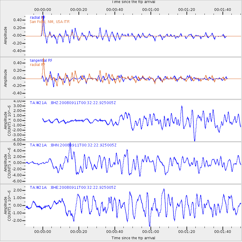
Signal To Noise
| Channel | StoN | STA | LTA |
| TA:W21A: :BHN:20080911T00:32:22.925005Z | 2.6179383 | 6.909987E-7 | 2.6394767E-7 |
| TA:W21A: :BHE:20080911T00:32:22.925005Z | 0.81356806 | 2.0595552E-7 | 2.5315092E-7 |
| TA:W21A: :BHZ:20080911T00:32:22.925005Z | 0.6727269 | 1.4625172E-7 | 2.1740132E-7 |
| Arrivals |
| Ps | 4.1 SECOND |
| PpPs | 17 SECOND |
| PsPs/PpSs | 21 SECOND |


