You are here: Home > Network List > TA - USArray Transportable Network (new EarthScope stations) Stations List
> Station T25A Trinidad, CO, USA > Earthquake Result Viewer
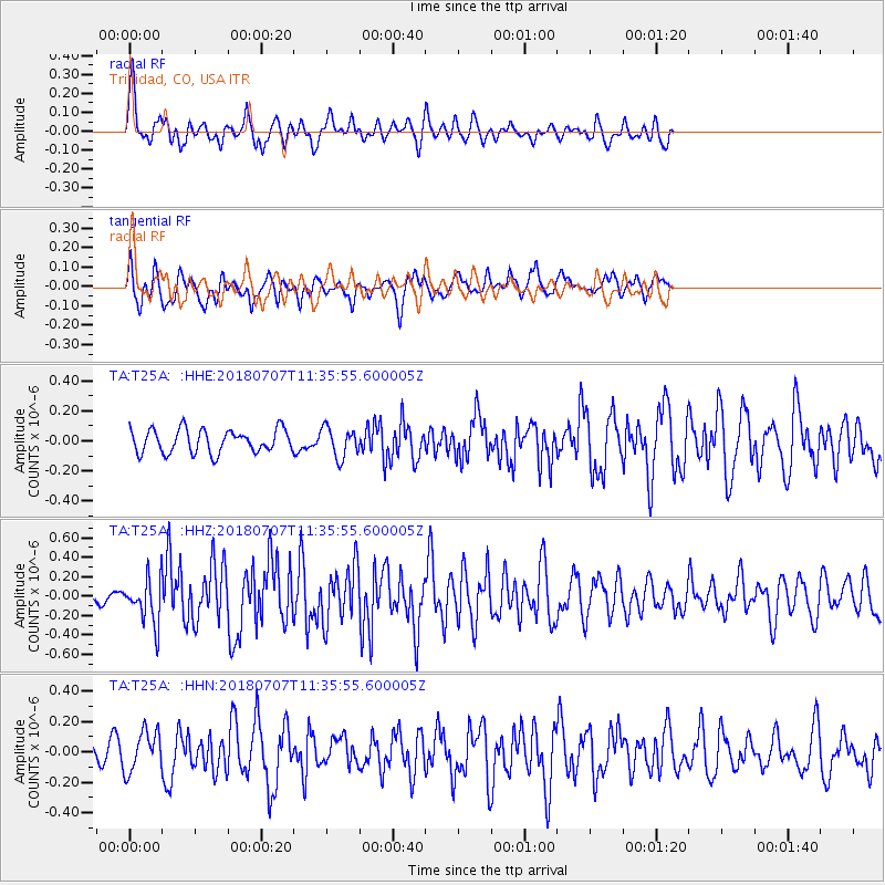
T25A Trinidad, CO, USA - Earthquake Result Viewer
*The percent match for this event was below the threshold and hence no stack was calculated.
| Earthquake location: |
Near East Coast Of Honshu, Japan |
| Earthquake latitude/longitude: |
35.1/140.7 |
| Earthquake time(UTC): |
2018/07/07 (188) 11:23:49 GMT |
| Earthquake Depth: |
39 km |
| Earthquake Magnitude: |
5.9 Mww |
| Earthquake Catalog/Contributor: |
NEIC PDE/us |
|
| Network: |
TA USArray Transportable Network (new EarthScope stations) |
| Station: |
T25A Trinidad, CO, USA |
| Lat/Lon: |
37.14 N/104.41 W |
| Elevation: |
2017 m |
|
| Distance: |
86.1 deg |
| Az: |
46.577 deg |
| Baz: |
311.813 deg |
| Ray Param: |
$rayparam |
*The percent match for this event was below the threshold and hence was not used in the summary stack. |
|
| Radial Match: |
73.81825 % |
| Radial Bump: |
400 |
| Transverse Match: |
68.44398 % |
| Transverse Bump: |
389 |
| SOD ConfigId: |
13570011 |
| Insert Time: |
2019-04-30 12:59:01.840 +0000 |
| GWidth: |
2.5 |
| Max Bumps: |
400 |
| Tol: |
0.001 |
|
Signal To Noise
| Channel | StoN | STA | LTA |
| TA:T25A: :HHZ:20180707T11:35:55.600005Z | 4.01222 | 2.3290218E-7 | 5.8048204E-8 |
| TA:T25A: :HHN:20180707T11:35:55.600005Z | 2.4861171 | 1.3236352E-7 | 5.3241063E-8 |
| TA:T25A: :HHE:20180707T11:35:55.600005Z | 1.2685403 | 9.789858E-8 | 7.71742E-8 |
| Arrivals |
| Ps | |
| PpPs | |
| PsPs/PpSs | |


