W21A San Fidel, NM, USA - Earthquake Result Viewer
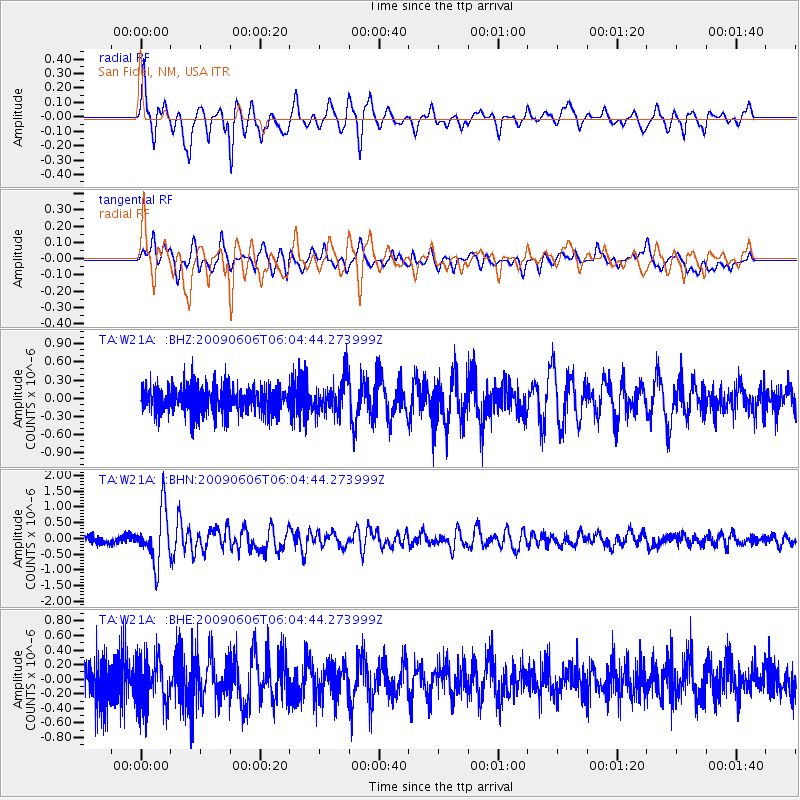
Earthquake location: Near East Coast Of Honshu, Japan
Earthquake latitude/longitude: 35.5/140.9
Earthquake time(UTC): 2009/06/06 (157) 05:52:43 GMT
Earthquake Depth: 34 km
Earthquake Magnitude: 5.8 MB, 5.4 MS, 5.8 MW, 5.7 MW
Earthquake Catalog/Contributor: WHDF/NEIC
Network: TA USArray Transportable Network (new EarthScope stations)
Station: W21A San Fidel, NM, USA
Lat/Lon: 35.12 N/107.65 W
Elevation: 1966 m
Distance: 85.0 deg
Az: 49.99 deg
Baz: 310.314 deg
Ray Param: 0.045001924
Estimated Moho Depth: 42.0 km
Estimated Crust Vp/Vs: 1.60
Assumed Crust Vp: 6.502 km/s
Estimated Crust Vs: 4.063 km/s
Estimated Crust Poisson's Ratio: 0.18
Radial Match: 87.96299 %
Radial Bump: 400
Transverse Match: 76.64647 %
Transverse Bump: 400
SOD ConfigId: 2648
Insert Time: 2010-03-06 12:30:31.615 +0000
GWidth: 2.5
Max Bumps: 400
Tol: 0.001

Signal To Noise

ChannelStoNSTALTA
TA:W21A: :BHN:20090606T06:04:44.273999Z7.76366478.3107534E-71.0704678E-7
TA:W21A: :BHE:20090606T06:04:44.273999Z1.28215233.3845745E-72.63976E-7
TA:W21A: :BHZ:20090606T06:04:44.273999Z1.29695142.8450745E-72.1936633E-7
Arrivals
Ps4.0 SECOND
PpPs16 SECOND
PsPs/PpSs20 SECOND