
W21A San Fidel, NM, USA - Earthquake Result Viewer
| ||||||||||||||||||
| ||||||||||||||||||
| ||||||||||||||||||
|
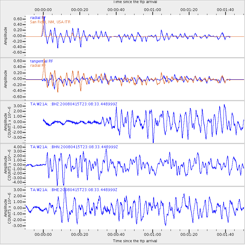
Signal To Noise
| Channel | StoN | STA | LTA |
| TA:W21A: :BHN:20080415T23:08:33.448999Z | 10.806495 | 1.3108898E-6 | 1.2130573E-7 |
| TA:W21A: :BHE:20080415T23:08:33.448999Z | 1.7026523 | 4.4315843E-7 | 2.6027536E-7 |
| TA:W21A: :BHZ:20080415T23:08:33.448999Z | 1.7002237 | 3.8646616E-7 | 2.2730312E-7 |
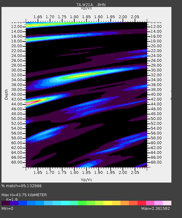
| Arrivals | |
| Ps | 4.3 SECOND |
| PpPs | 16 SECOND |
| PsPs/PpSs | 21 SECOND |

