You are here: Home > Network List > CI - Caltech Regional Seismic Network Stations List
> Station MPP McPhearson Peak > Earthquake Result Viewer
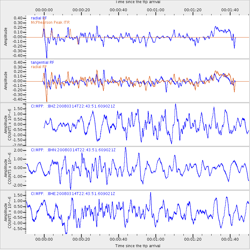
MPP McPhearson Peak - Earthquake Result Viewer
*The percent match for this event was below the threshold and hence no stack was calculated.
| Earthquake location: |
Bonin Islands, Japan Region |
| Earthquake latitude/longitude: |
27.0/142.6 |
| Earthquake time(UTC): |
2008/03/14 (074) 22:32:09 GMT |
| Earthquake Depth: |
11 km |
| Earthquake Magnitude: |
5.7 MB, 5.9 MS, 6.0 MW, 6.0 MW |
| Earthquake Catalog/Contributor: |
WHDF/NEIC |
|
| Network: |
CI Caltech Regional Seismic Network |
| Station: |
MPP McPhearson Peak |
| Lat/Lon: |
34.89 N/119.81 W |
| Elevation: |
1739 m |
|
| Distance: |
80.8 deg |
| Az: |
55.641 deg |
| Baz: |
296.352 deg |
| Ray Param: |
$rayparam |
*The percent match for this event was below the threshold and hence was not used in the summary stack. |
|
| Radial Match: |
56.704315 % |
| Radial Bump: |
400 |
| Transverse Match: |
43.57113 % |
| Transverse Bump: |
400 |
| SOD ConfigId: |
2504 |
| Insert Time: |
2010-02-26 02:04:30.525 +0000 |
| GWidth: |
2.5 |
| Max Bumps: |
400 |
| Tol: |
0.001 |
|
Signal To Noise
| Channel | StoN | STA | LTA |
| CI:MPP: :BHN:20080314T22:43:51.609021Z | 0.9514999 | 5.9268837E-7 | 6.2289905E-7 |
| CI:MPP: :BHE:20080314T22:43:51.609021Z | 1.4380457 | 6.4436756E-7 | 4.4808561E-7 |
| CI:MPP: :BHZ:20080314T22:43:51.609021Z | 2.1145103 | 8.160776E-7 | 3.8594163E-7 |
| Arrivals |
| Ps | |
| PpPs | |
| PsPs/PpSs | |


