You are here: Home > Network List > UW - Pacific Northwest Regional Seismic Network Stations List
> Station UMAT Pilot Rock, OR, USA > Earthquake Result Viewer
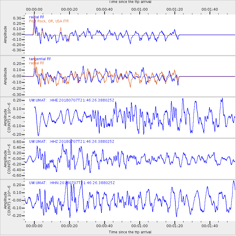
UMAT Pilot Rock, OR, USA - Earthquake Result Viewer
*The percent match for this event was below the threshold and hence no stack was calculated.
| Earthquake location: |
Kermadec Islands, New Zealand |
| Earthquake latitude/longitude: |
-30.6/-178.0 |
| Earthquake time(UTC): |
2018/07/07 (188) 21:33:49 GMT |
| Earthquake Depth: |
34 km |
| Earthquake Magnitude: |
5.9 Mww |
| Earthquake Catalog/Contributor: |
NEIC PDE/us |
|
| Network: |
UW Pacific Northwest Regional Seismic Network |
| Station: |
UMAT Pilot Rock, OR, USA |
| Lat/Lon: |
45.29 N/118.96 W |
| Elevation: |
1318 m |
|
| Distance: |
92.6 deg |
| Az: |
37.309 deg |
| Baz: |
227.753 deg |
| Ray Param: |
$rayparam |
*The percent match for this event was below the threshold and hence was not used in the summary stack. |
|
| Radial Match: |
76.5899 % |
| Radial Bump: |
400 |
| Transverse Match: |
52.7119 % |
| Transverse Bump: |
372 |
| SOD ConfigId: |
13570011 |
| Insert Time: |
2019-04-30 13:07:13.477 +0000 |
| GWidth: |
2.5 |
| Max Bumps: |
400 |
| Tol: |
0.001 |
|
Signal To Noise
| Channel | StoN | STA | LTA |
| UW:UMAT: :HHZ:20180707T21:46:26.388025Z | 2.898631 | 1.9440495E-7 | 6.7067845E-8 |
| UW:UMAT: :HHN:20180707T21:46:26.388025Z | 1.2836211 | 7.304151E-8 | 5.690271E-8 |
| UW:UMAT: :HHE:20180707T21:46:26.388025Z | 0.59582835 | 4.179312E-8 | 7.014288E-8 |
| Arrivals |
| Ps | |
| PpPs | |
| PsPs/PpSs | |


