You are here: Home > Network List > TA - USArray Transportable Network (new EarthScope stations) Stations List
> Station W21A San Fidel, NM, USA > Earthquake Result Viewer
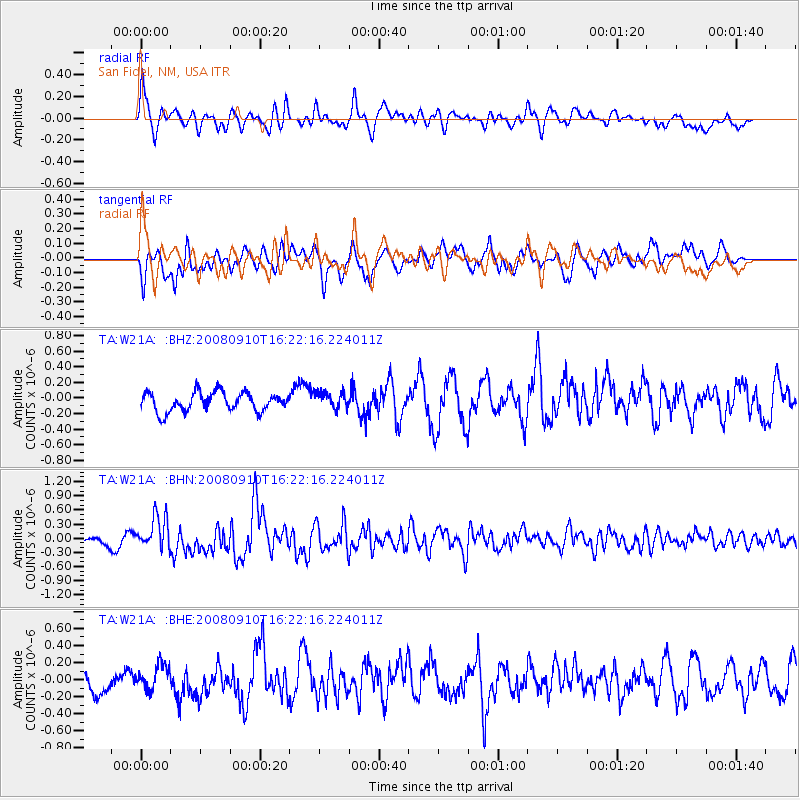
W21A San Fidel, NM, USA - Earthquake Result Viewer
*The percent match for this event was below the threshold and hence no stack was calculated.
| Earthquake location: |
Northern Chile |
| Earthquake latitude/longitude: |
-20.3/-69.2 |
| Earthquake time(UTC): |
2008/09/10 (254) 16:12:04 GMT |
| Earthquake Depth: |
38 km |
| Earthquake Magnitude: |
5.6 MB, 5.3 MS |
| Earthquake Catalog/Contributor: |
WHDF/NEIC |
|
| Network: |
TA USArray Transportable Network (new EarthScope stations) |
| Station: |
W21A San Fidel, NM, USA |
| Lat/Lon: |
35.12 N/107.65 W |
| Elevation: |
1966 m |
|
| Distance: |
66.1 deg |
| Az: |
326.12 deg |
| Baz: |
140.326 deg |
| Ray Param: |
$rayparam |
*The percent match for this event was below the threshold and hence was not used in the summary stack. |
|
| Radial Match: |
68.02657 % |
| Radial Bump: |
400 |
| Transverse Match: |
48.466614 % |
| Transverse Bump: |
400 |
| SOD ConfigId: |
2560 |
| Insert Time: |
2010-03-06 12:31:58.652 +0000 |
| GWidth: |
2.5 |
| Max Bumps: |
400 |
| Tol: |
0.001 |
|
Signal To Noise
| Channel | StoN | STA | LTA |
| TA:W21A: :BHN:20080910T16:22:16.224011Z | 3.5021808 | 3.5345965E-7 | 1.0092559E-7 |
| TA:W21A: :BHE:20080910T16:22:16.224011Z | 0.86470187 | 1.397913E-7 | 1.6166415E-7 |
| TA:W21A: :BHZ:20080910T16:22:16.224011Z | 0.87224823 | 1.0511293E-7 | 1.2050805E-7 |
| Arrivals |
| Ps | |
| PpPs | |
| PsPs/PpSs | |


