You are here: Home > Network List > TA - USArray Transportable Network (new EarthScope stations) Stations List
> Station W21A San Fidel, NM, USA > Earthquake Result Viewer
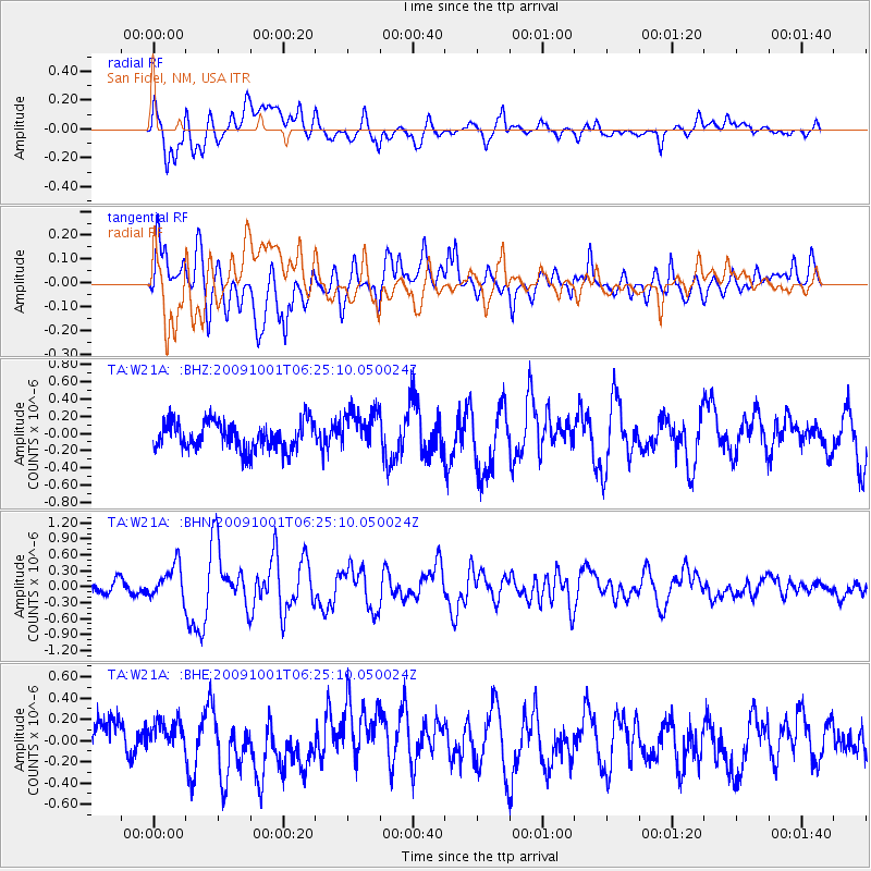
W21A San Fidel, NM, USA - Earthquake Result Viewer
*The percent match for this event was below the threshold and hence no stack was calculated.
| Earthquake location: |
Tonga Islands |
| Earthquake latitude/longitude: |
-15.4/-173.3 |
| Earthquake time(UTC): |
2009/10/01 (274) 06:13:32 GMT |
| Earthquake Depth: |
10 km |
| Earthquake Magnitude: |
5.6 MB, 5.7 MS, 5.8 MW, 5.7 MW |
| Earthquake Catalog/Contributor: |
WHDF/NEIC |
|
| Network: |
TA USArray Transportable Network (new EarthScope stations) |
| Station: |
W21A San Fidel, NM, USA |
| Lat/Lon: |
35.12 N/107.65 W |
| Elevation: |
1966 m |
|
| Distance: |
79.9 deg |
| Az: |
49.322 deg |
| Baz: |
243.17 deg |
| Ray Param: |
$rayparam |
*The percent match for this event was below the threshold and hence was not used in the summary stack. |
|
| Radial Match: |
72.03528 % |
| Radial Bump: |
400 |
| Transverse Match: |
74.28436 % |
| Transverse Bump: |
400 |
| SOD ConfigId: |
2622 |
| Insert Time: |
2010-03-06 12:32:16.386 +0000 |
| GWidth: |
2.5 |
| Max Bumps: |
400 |
| Tol: |
0.001 |
|
Signal To Noise
| Channel | StoN | STA | LTA |
| TA:W21A: :BHN:20091001T06:25:10.050024Z | 2.21409 | 3.1141812E-7 | 1.4065286E-7 |
| TA:W21A: :BHE:20091001T06:25:10.050024Z | 0.77267456 | 1.5726557E-7 | 2.0353404E-7 |
| TA:W21A: :BHZ:20091001T06:25:10.050024Z | 1.4367181 | 2.3369748E-7 | 1.6266063E-7 |
| Arrivals |
| Ps | |
| PpPs | |
| PsPs/PpSs | |


