You are here: Home > Network List > CI - Caltech Regional Seismic Network Stations List
> Station MPP McPhearson Peak > Earthquake Result Viewer
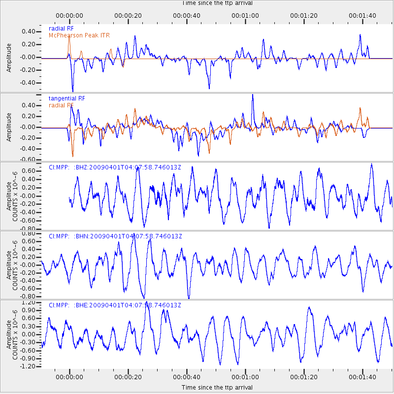
MPP McPhearson Peak - Earthquake Result Viewer
*The percent match for this event was below the threshold and hence no stack was calculated.
| Earthquake location: |
Near N Coast Of New Guinea, P.N.G. |
| Earthquake latitude/longitude: |
-3.5/144.1 |
| Earthquake time(UTC): |
2009/04/01 (091) 03:54:58 GMT |
| Earthquake Depth: |
10 km |
| Earthquake Magnitude: |
5.9 MB, 6.5 MS, 6.4 MW, 6.4 MW |
| Earthquake Catalog/Contributor: |
WHDF/NEIC |
|
| Network: |
CI Caltech Regional Seismic Network |
| Station: |
MPP McPhearson Peak |
| Lat/Lon: |
34.89 N/119.81 W |
| Elevation: |
1739 m |
|
| Distance: |
97.0 deg |
| Az: |
55.442 deg |
| Baz: |
270.582 deg |
| Ray Param: |
$rayparam |
*The percent match for this event was below the threshold and hence was not used in the summary stack. |
|
| Radial Match: |
61.256752 % |
| Radial Bump: |
400 |
| Transverse Match: |
63.910435 % |
| Transverse Bump: |
400 |
| SOD ConfigId: |
2658 |
| Insert Time: |
2010-02-26 02:04:31.131 +0000 |
| GWidth: |
2.5 |
| Max Bumps: |
400 |
| Tol: |
0.001 |
|
Signal To Noise
| Channel | StoN | STA | LTA |
| CI:MPP: :BHN:20090401T04:07:58.746013Z | 0.9280756 | 2.3591876E-7 | 2.542021E-7 |
| CI:MPP: :BHE:20090401T04:07:58.746013Z | 0.99291366 | 3.3678606E-7 | 3.3918968E-7 |
| CI:MPP: :BHZ:20090401T04:07:58.746013Z | 0.694944 | 2.029942E-7 | 2.921015E-7 |
| Arrivals |
| Ps | |
| PpPs | |
| PsPs/PpSs | |


