You are here: Home > Network List > CI - Caltech Regional Seismic Network Stations List
> Station MPP McPhearson Peak > Earthquake Result Viewer
MPP McPhearson Peak - Earthquake Result Viewer
*The percent match for this event was below the threshold and hence no stack was calculated.
| Earthquake location: |
Loyalty Islands |
| Earthquake latitude/longitude: |
-20.3/168.9 |
| Earthquake time(UTC): |
2008/04/10 (101) 01:10:02 GMT |
| Earthquake Depth: |
35 km |
| Earthquake Magnitude: |
5.5 MB, 5.5 MS, 5.8 MW |
| Earthquake Catalog/Contributor: |
WHDF/NEIC |
|
| Network: |
CI Caltech Regional Seismic Network |
| Station: |
MPP McPhearson Peak |
| Lat/Lon: |
34.89 N/119.81 W |
| Elevation: |
1739 m |
|
| Distance: |
87.1 deg |
| Az: |
51.211 deg |
| Baz: |
242.849 deg |
| Ray Param: |
$rayparam |
*The percent match for this event was below the threshold and hence was not used in the summary stack. |
|
| Radial Match: |
42.909218 % |
| Radial Bump: |
400 |
| Transverse Match: |
54.175552 % |
| Transverse Bump: |
400 |
| SOD ConfigId: |
2504 |
| Insert Time: |
2010-02-26 02:04:33.901 +0000 |
| GWidth: |
2.5 |
| Max Bumps: |
400 |
| Tol: |
0.001 |
|
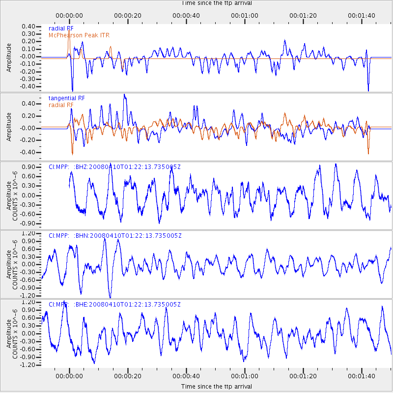
Signal To Noise
| Channel | StoN | STA | LTA |
| CI:MPP: :BHN:20080410T01:22:13.735005Z | 2.7361145 | 6.2428313E-7 | 2.2816411E-7 |
| CI:MPP: :BHE:20080410T01:22:13.735005Z | 1.1701436 | 5.669661E-7 | 4.845269E-7 |
| CI:MPP: :BHZ:20080410T01:22:13.735005Z | 1.0206776 | 4.6115392E-7 | 4.5181153E-7 |
| Arrivals |
| Ps | |
| PpPs | |
| PsPs/PpSs | |


