You are here: Home > Network List > TA - USArray Transportable Network (new EarthScope stations) Stations List
> Station W21A San Fidel, NM, USA > Earthquake Result Viewer
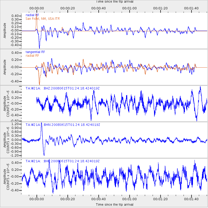
W21A San Fidel, NM, USA - Earthquake Result Viewer
*The percent match for this event was below the threshold and hence no stack was calculated.
| Earthquake location: |
Fiji Islands Region |
| Earthquake latitude/longitude: |
-17.7/-179.7 |
| Earthquake time(UTC): |
2008/06/15 (167) 01:13:11 GMT |
| Earthquake Depth: |
611 km |
| Earthquake Magnitude: |
5.5 MB, 5.9 MW, 5.9 MW |
| Earthquake Catalog/Contributor: |
WHDF/NEIC |
|
| Network: |
TA USArray Transportable Network (new EarthScope stations) |
| Station: |
W21A San Fidel, NM, USA |
| Lat/Lon: |
35.12 N/107.65 W |
| Elevation: |
1966 m |
|
| Distance: |
86.2 deg |
| Az: |
51.426 deg |
| Baz: |
245.353 deg |
| Ray Param: |
$rayparam |
*The percent match for this event was below the threshold and hence was not used in the summary stack. |
|
| Radial Match: |
68.664055 % |
| Radial Bump: |
400 |
| Transverse Match: |
69.93788 % |
| Transverse Bump: |
399 |
| SOD ConfigId: |
2504 |
| Insert Time: |
2010-03-06 12:33:20.083 +0000 |
| GWidth: |
2.5 |
| Max Bumps: |
400 |
| Tol: |
0.001 |
|
Signal To Noise
| Channel | StoN | STA | LTA |
| TA:W21A: :BHN:20080615T01:24:18.424019Z | 4.843922 | 5.6727123E-7 | 1.171099E-7 |
| TA:W21A: :BHE:20080615T01:24:18.424019Z | 0.9178523 | 9.8111606E-8 | 1.06892585E-7 |
| TA:W21A: :BHZ:20080615T01:24:18.424019Z | 0.8730293 | 1.3090514E-7 | 1.4994357E-7 |
| Arrivals |
| Ps | |
| PpPs | |
| PsPs/PpSs | |


