You are here: Home > Network List > TA - USArray Transportable Network (new EarthScope stations) Stations List
> Station W21A San Fidel, NM, USA > Earthquake Result Viewer
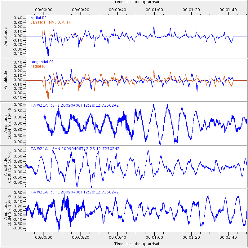
W21A San Fidel, NM, USA - Earthquake Result Viewer
*The percent match for this event was below the threshold and hence no stack was calculated.
| Earthquake location: |
Tonga Islands Region |
| Earthquake latitude/longitude: |
-22.4/-174.9 |
| Earthquake time(UTC): |
2009/04/06 (096) 12:16:08 GMT |
| Earthquake Depth: |
35 km |
| Earthquake Magnitude: |
5.5 MS, 5.4 MB |
| Earthquake Catalog/Contributor: |
WHDF/NEIC |
|
| Network: |
TA USArray Transportable Network (new EarthScope stations) |
| Station: |
W21A San Fidel, NM, USA |
| Lat/Lon: |
35.12 N/107.65 W |
| Elevation: |
1966 m |
|
| Distance: |
85.6 deg |
| Az: |
49.326 deg |
| Baz: |
238.901 deg |
| Ray Param: |
$rayparam |
*The percent match for this event was below the threshold and hence was not used in the summary stack. |
|
| Radial Match: |
74.117 % |
| Radial Bump: |
391 |
| Transverse Match: |
77.612595 % |
| Transverse Bump: |
346 |
| SOD ConfigId: |
2658 |
| Insert Time: |
2010-03-06 12:33:27.948 +0000 |
| GWidth: |
2.5 |
| Max Bumps: |
400 |
| Tol: |
0.001 |
|
Signal To Noise
| Channel | StoN | STA | LTA |
| TA:W21A: :BHN:20090406T12:28:12.725024Z | 2.9296763 | 5.734426E-7 | 1.9573582E-7 |
| TA:W21A: :BHE:20090406T12:28:12.725024Z | 0.8171947 | 2.5848055E-7 | 3.1630228E-7 |
| TA:W21A: :BHZ:20090406T12:28:12.725024Z | 1.1041747 | 3.3274006E-7 | 3.0134728E-7 |
| Arrivals |
| Ps | |
| PpPs | |
| PsPs/PpSs | |


