You are here: Home > Network List > CI - Caltech Regional Seismic Network Stations List
> Station MPP McPhearson Peak > Earthquake Result Viewer
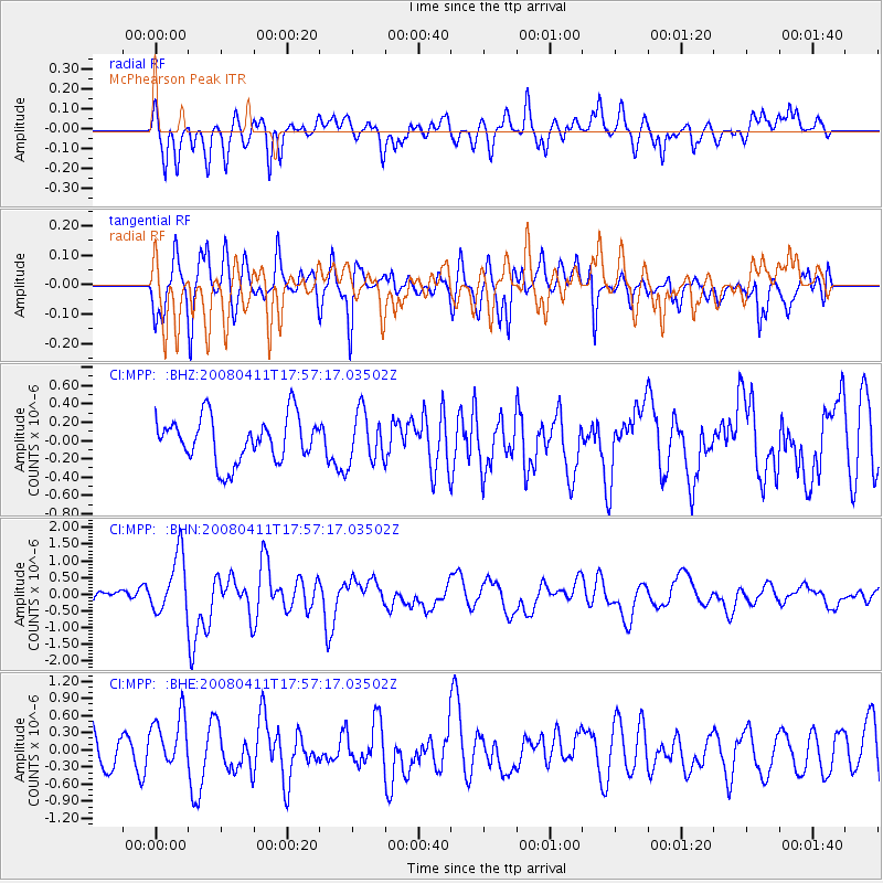
MPP McPhearson Peak - Earthquake Result Viewer
*The percent match for this event was below the threshold and hence no stack was calculated.
| Earthquake location: |
Loyalty Islands |
| Earthquake latitude/longitude: |
-20.4/168.8 |
| Earthquake time(UTC): |
2008/04/11 (102) 17:45:05 GMT |
| Earthquake Depth: |
35 km |
| Earthquake Magnitude: |
5.7 MB, 5.9 MS, 6.0 MW, 6.0 MW |
| Earthquake Catalog/Contributor: |
WHDF/NEIC |
|
| Network: |
CI Caltech Regional Seismic Network |
| Station: |
MPP McPhearson Peak |
| Lat/Lon: |
34.89 N/119.81 W |
| Elevation: |
1739 m |
|
| Distance: |
87.2 deg |
| Az: |
51.253 deg |
| Baz: |
242.864 deg |
| Ray Param: |
$rayparam |
*The percent match for this event was below the threshold and hence was not used in the summary stack. |
|
| Radial Match: |
60.45591 % |
| Radial Bump: |
400 |
| Transverse Match: |
65.40086 % |
| Transverse Bump: |
400 |
| SOD ConfigId: |
2504 |
| Insert Time: |
2010-02-26 02:04:34.474 +0000 |
| GWidth: |
2.5 |
| Max Bumps: |
400 |
| Tol: |
0.001 |
|
Signal To Noise
| Channel | StoN | STA | LTA |
| CI:MPP: :BHN:20080411T17:57:17.03502Z | 4.0768933 | 8.8076155E-7 | 2.1603744E-7 |
| CI:MPP: :BHE:20080411T17:57:17.03502Z | 1.8264709 | 4.586454E-7 | 2.5111015E-7 |
| CI:MPP: :BHZ:20080411T17:57:17.03502Z | 1.1240071 | 2.750241E-7 | 2.4468184E-7 |
| Arrivals |
| Ps | |
| PpPs | |
| PsPs/PpSs | |


