
ATD Arta Cave - Arta, Republic of Djibouti - Earthquake Result Viewer
| ||||||||||||||||||
| ||||||||||||||||||
| ||||||||||||||||||
|
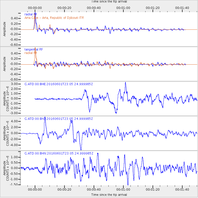
Signal To Noise
| Channel | StoN | STA | LTA |
| G:ATD:00:BHZ:20160601T23:05:24.999985Z | 28.240738 | 1.5806893E-6 | 5.5971956E-8 |
| G:ATD:00:BHN:20160601T23:05:24.999985Z | 3.5033984 | 2.2417038E-7 | 6.3986555E-8 |
| G:ATD:00:BHE:20160601T23:05:24.999985Z | 14.406398 | 9.0428426E-7 | 6.276963E-8 |
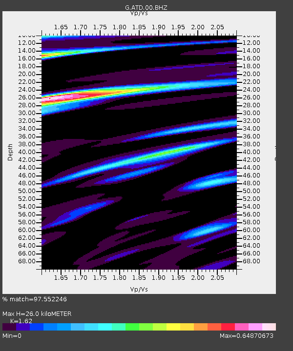
| Arrivals | |
| Ps | 2.7 SECOND |
| PpPs | 10 SECOND |
| PsPs/PpSs | 13 SECOND |

