ABPO Ambohimpanompo, Madagascar - Earthquake Result Viewer
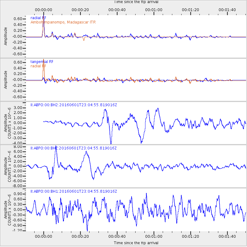
Earthquake location: Southern Sumatra, Indonesia
Earthquake latitude/longitude: -2.1/100.7
Earthquake time(UTC): 2016/06/01 (153) 22:56:00 GMT
Earthquake Depth: 50 km
Earthquake Magnitude: 6.6 MWW, 6.4 MWB, 6.6 MWC, 6.7 MWC
Earthquake Catalog/Contributor: NEIC PDE/NEIC COMCAT
Network: II Global Seismograph Network (GSN - IRIS/IDA)
Station: ABPO Ambohimpanompo, Madagascar
Lat/Lon: 19.02 S/47.23 E
Elevation: 1528 m
Distance: 54.9 deg
Az: 248.243 deg
Baz: 78.826 deg
Ray Param: 0.06502232
Estimated Moho Depth: 35.25 km
Estimated Crust Vp/Vs: 1.85
Assumed Crust Vp: 6.642 km/s
Estimated Crust Vs: 3.595 km/s
Estimated Crust Poisson's Ratio: 0.29
Radial Match: 95.29309 %
Radial Bump: 308
Transverse Match: 74.39892 %
Transverse Bump: 400
SOD ConfigId: 1609551
Insert Time: 2016-06-22 14:46:32.794 +0000
GWidth: 2.5
Max Bumps: 400
Tol: 0.001

Signal To Noise

ChannelStoNSTALTA
II:ABPO:00:BHZ:20160601T23:04:55.819016Z7.8064722.5667152E-63.2879325E-7
II:ABPO:00:BH1:20160601T23:04:55.819016Z1.5092493.5422102E-72.347002E-7
II:ABPO:00:BH2:20160601T23:04:55.819016Z4.7378481.3991387E-62.9531105E-7
Arrivals
Ps4.7 SECOND
PpPs14 SECOND
PsPs/PpSs19 SECOND