You are here: Home > Network List > TA - USArray Transportable Network (new EarthScope stations) Stations List
> Station G31M Satah River, YT, CAN > Earthquake Result Viewer
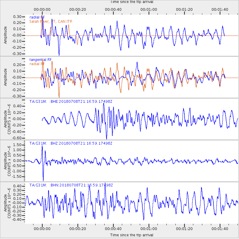
G31M Satah River, YT, CAN - Earthquake Result Viewer
*The percent match for this event was below the threshold and hence no stack was calculated.
| Earthquake location: |
Vanuatu Islands |
| Earthquake latitude/longitude: |
-19.0/169.5 |
| Earthquake time(UTC): |
2018/07/08 (189) 21:04:36 GMT |
| Earthquake Depth: |
259 km |
| Earthquake Magnitude: |
5.5 Mww |
| Earthquake Catalog/Contributor: |
NEIC PDE/us |
|
| Network: |
TA USArray Transportable Network (new EarthScope stations) |
| Station: |
G31M Satah River, YT, CAN |
| Lat/Lon: |
66.92 N/134.27 W |
| Elevation: |
61 m |
|
| Distance: |
95.2 deg |
| Az: |
19.209 deg |
| Baz: |
232.142 deg |
| Ray Param: |
$rayparam |
*The percent match for this event was below the threshold and hence was not used in the summary stack. |
|
| Radial Match: |
59.214046 % |
| Radial Bump: |
400 |
| Transverse Match: |
50.32693 % |
| Transverse Bump: |
400 |
| SOD ConfigId: |
13570011 |
| Insert Time: |
2019-04-30 13:20:33.113 +0000 |
| GWidth: |
2.5 |
| Max Bumps: |
400 |
| Tol: |
0.001 |
|
Signal To Noise
| Channel | StoN | STA | LTA |
| TA:G31M: :BHZ:20180708T21:16:59.17498Z | 8.533422 | 6.4708837E-7 | 7.5829874E-8 |
| TA:G31M: :BHN:20180708T21:16:59.17498Z | 1.4375466 | 1.5284606E-7 | 1.0632424E-7 |
| TA:G31M: :BHE:20180708T21:16:59.17498Z | 2.1078124 | 2.515102E-7 | 1.1932285E-7 |
| Arrivals |
| Ps | |
| PpPs | |
| PsPs/PpSs | |


