You are here: Home > Network List > TA - USArray Transportable Network (new EarthScope stations) Stations List
> Station M31M Drury Creek, Yukon, CA > Earthquake Result Viewer
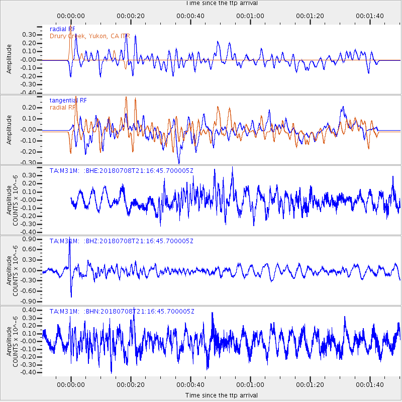
M31M Drury Creek, Yukon, CA - Earthquake Result Viewer
*The percent match for this event was below the threshold and hence no stack was calculated.
| Earthquake location: |
Vanuatu Islands |
| Earthquake latitude/longitude: |
-19.0/169.5 |
| Earthquake time(UTC): |
2018/07/08 (189) 21:04:36 GMT |
| Earthquake Depth: |
259 km |
| Earthquake Magnitude: |
5.5 Mww |
| Earthquake Catalog/Contributor: |
NEIC PDE/us |
|
| Network: |
TA USArray Transportable Network (new EarthScope stations) |
| Station: |
M31M Drury Creek, Yukon, CA |
| Lat/Lon: |
62.20 N/134.39 W |
| Elevation: |
639 m |
|
| Distance: |
92.2 deg |
| Az: |
22.919 deg |
| Baz: |
231.793 deg |
| Ray Param: |
$rayparam |
*The percent match for this event was below the threshold and hence was not used in the summary stack. |
|
| Radial Match: |
59.44574 % |
| Radial Bump: |
400 |
| Transverse Match: |
58.165318 % |
| Transverse Bump: |
400 |
| SOD ConfigId: |
13570011 |
| Insert Time: |
2019-04-30 13:21:13.474 +0000 |
| GWidth: |
2.5 |
| Max Bumps: |
400 |
| Tol: |
0.001 |
|
Signal To Noise
| Channel | StoN | STA | LTA |
| TA:M31M: :BHZ:20180708T21:16:45.700005Z | 3.3324823 | 3.0048224E-7 | 9.0167696E-8 |
| TA:M31M: :BHN:20180708T21:16:45.700005Z | 1.5670146 | 1.3288027E-7 | 8.4798366E-8 |
| TA:M31M: :BHE:20180708T21:16:45.700005Z | 1.2464743 | 1.0607988E-7 | 8.510395E-8 |
| Arrivals |
| Ps | |
| PpPs | |
| PsPs/PpSs | |


