You are here: Home > Network List > TA - USArray Transportable Network (new EarthScope stations) Stations List
> Station R31K City Hall, Gustavus, AK, USA > Earthquake Result Viewer
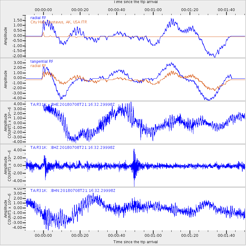
R31K City Hall, Gustavus, AK, USA - Earthquake Result Viewer
*The percent match for this event was below the threshold and hence no stack was calculated.
| Earthquake location: |
Vanuatu Islands |
| Earthquake latitude/longitude: |
-19.0/169.5 |
| Earthquake time(UTC): |
2018/07/08 (189) 21:04:36 GMT |
| Earthquake Depth: |
259 km |
| Earthquake Magnitude: |
5.5 Mww |
| Earthquake Catalog/Contributor: |
NEIC PDE/us |
|
| Network: |
TA USArray Transportable Network (new EarthScope stations) |
| Station: |
R31K City Hall, Gustavus, AK, USA |
| Lat/Lon: |
58.41 N/135.74 W |
| Elevation: |
15 m |
|
| Distance: |
89.3 deg |
| Az: |
25.46 deg |
| Baz: |
230.588 deg |
| Ray Param: |
$rayparam |
*The percent match for this event was below the threshold and hence was not used in the summary stack. |
|
| Radial Match: |
33.005154 % |
| Radial Bump: |
400 |
| Transverse Match: |
40.702446 % |
| Transverse Bump: |
400 |
| SOD ConfigId: |
13570011 |
| Insert Time: |
2019-04-30 13:21:42.467 +0000 |
| GWidth: |
2.5 |
| Max Bumps: |
400 |
| Tol: |
0.001 |
|
Signal To Noise
| Channel | StoN | STA | LTA |
| TA:R31K: :BHZ:20180708T21:16:32.29998Z | 2.070959 | 1.0108789E-6 | 4.8812115E-7 |
| TA:R31K: :BHN:20180708T21:16:32.29998Z | 2.3478935 | 3.0336623E-6 | 1.2920784E-6 |
| TA:R31K: :BHE:20180708T21:16:32.29998Z | 0.38463542 | 9.932108E-7 | 2.5822137E-6 |
| Arrivals |
| Ps | |
| PpPs | |
| PsPs/PpSs | |


