You are here: Home > Network List > TJ - Tajikistan National Seismic Network Stations List
> Station GARM Garm, Tajikistan > Earthquake Result Viewer
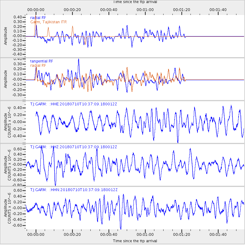
GARM Garm, Tajikistan - Earthquake Result Viewer
*The percent match for this event was below the threshold and hence no stack was calculated.
| Earthquake location: |
Southwest Indian Ridge |
| Earthquake latitude/longitude: |
-31.6/58.3 |
| Earthquake time(UTC): |
2018/07/10 (191) 10:26:21 GMT |
| Earthquake Depth: |
10 km |
| Earthquake Magnitude: |
5.6 Mww |
| Earthquake Catalog/Contributor: |
NEIC PDE/us |
|
| Network: |
TJ Tajikistan National Seismic Network |
| Station: |
GARM Garm, Tajikistan |
| Lat/Lon: |
39.00 N/70.32 E |
| Elevation: |
1305 m |
|
| Distance: |
71.1 deg |
| Az: |
9.832 deg |
| Baz: |
190.778 deg |
| Ray Param: |
$rayparam |
*The percent match for this event was below the threshold and hence was not used in the summary stack. |
|
| Radial Match: |
60.941067 % |
| Radial Bump: |
400 |
| Transverse Match: |
52.917755 % |
| Transverse Bump: |
400 |
| SOD ConfigId: |
13570011 |
| Insert Time: |
2019-04-30 13:26:23.065 +0000 |
| GWidth: |
2.5 |
| Max Bumps: |
400 |
| Tol: |
0.001 |
|
Signal To Noise
| Channel | StoN | STA | LTA |
| TJ:GARM: :HHZ:20180710T10:37:09.180012Z | 2.549961 | 3.2131175E-7 | 1.2600653E-7 |
| TJ:GARM: :HHN:20180710T10:37:09.180012Z | 0.8494641 | 9.313424E-8 | 1.09638826E-7 |
| TJ:GARM: :HHE:20180710T10:37:09.180012Z | 1.1438679 | 1.7777266E-7 | 1.5541364E-7 |
| Arrivals |
| Ps | |
| PpPs | |
| PsPs/PpSs | |


