
CIL Cilaos (Pompiers) - Earthquake Result Viewer
| ||||||||||||||||||
| ||||||||||||||||||
| ||||||||||||||||||
|
Signal To Noise
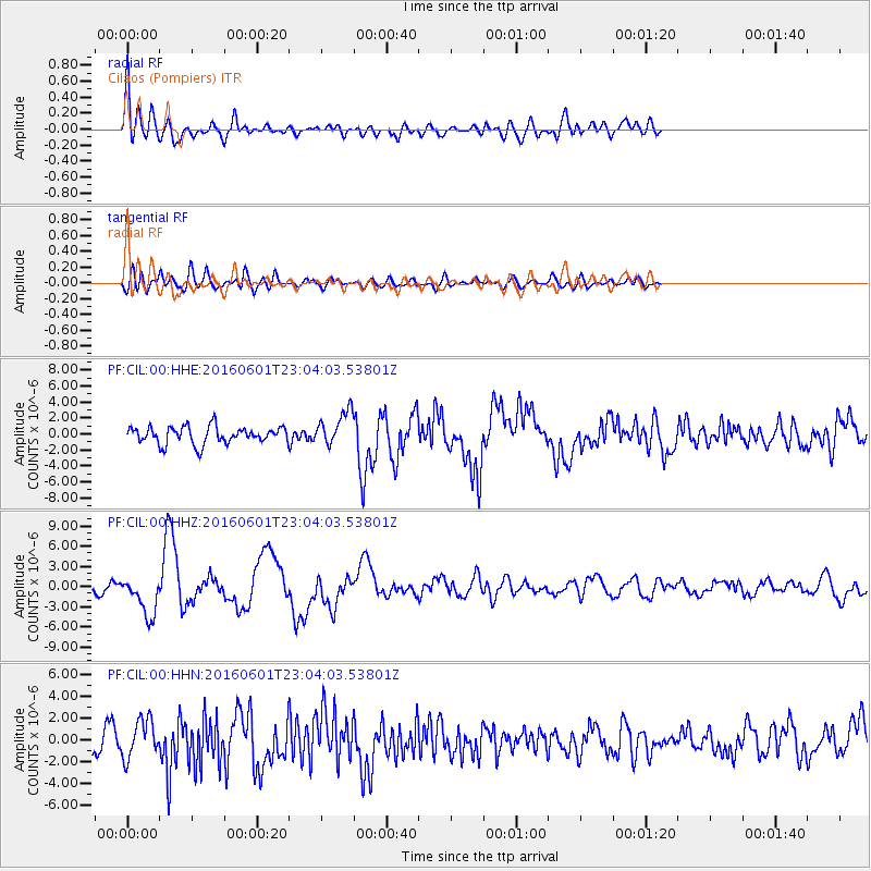
| Channel | StoN | STA | LTA |
| PF:CIL:00:HHZ:20160601T23:04:03.53801Z | 3.5457072 | 2.9552762E-6 | 8.3348E-7 |
| PF:CIL:00:HHN:20160601T23:04:03.53801Z | 1.8605471 | 1.7374566E-6 | 9.3384176E-7 |
| PF:CIL:00:HHE:20160601T23:04:03.53801Z | 1.9903122 | 2.1162903E-6 | 1.0632956E-6 |
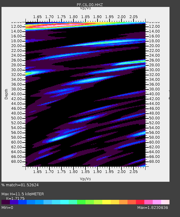
| Arrivals | |
| Ps | 1.8 SECOND |
| PpPs | 6.4 SECOND |
| PsPs/PpSs | 8.2 SECOND |

