You are here: Home > Network List > AZ - ANZA Regional Network Stations List
> Station SMER AZ.SMER > Earthquake Result Viewer
SMER AZ.SMER - Earthquake Result Viewer
*The percent match for this event was below the threshold and hence no stack was calculated.
| Earthquake location: |
South Of Fiji Islands |
| Earthquake latitude/longitude: |
-23.3/-179.9 |
| Earthquake time(UTC): |
2018/07/12 (193) 06:51:21 GMT |
| Earthquake Depth: |
540 km |
| Earthquake Magnitude: |
5.5 Mww |
| Earthquake Catalog/Contributor: |
NEIC PDE/us |
|
| Network: |
AZ ANZA Regional Network |
| Station: |
SMER AZ.SMER |
| Lat/Lon: |
33.46 N/117.17 W |
| Elevation: |
355 m |
|
| Distance: |
82.2 deg |
| Az: |
48.595 deg |
| Baz: |
235.549 deg |
| Ray Param: |
$rayparam |
*The percent match for this event was below the threshold and hence was not used in the summary stack. |
|
| Radial Match: |
67.04203 % |
| Radial Bump: |
400 |
| Transverse Match: |
46.143665 % |
| Transverse Bump: |
400 |
| SOD ConfigId: |
13570011 |
| Insert Time: |
2019-04-30 13:31:07.920 +0000 |
| GWidth: |
2.5 |
| Max Bumps: |
400 |
| Tol: |
0.001 |
|
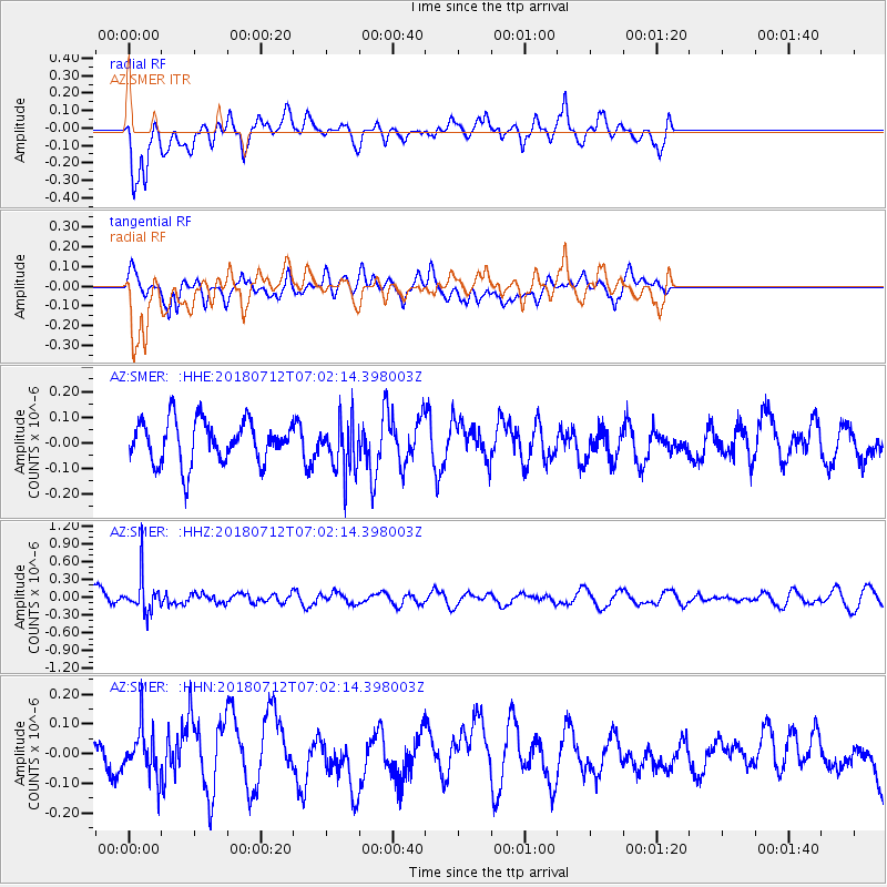
Signal To Noise
| Channel | StoN | STA | LTA |
| AZ:SMER: :HHZ:20180712T07:02:14.398003Z | 2.4300482 | 3.036763E-7 | 1.249672E-7 |
| AZ:SMER: :HHN:20180712T07:02:14.398003Z | 1.1505456 | 8.1554255E-8 | 7.088312E-8 |
| AZ:SMER: :HHE:20180712T07:02:14.398003Z | 1.229425 | 1.0158305E-7 | 8.262647E-8 |
| Arrivals |
| Ps | |
| PpPs | |
| PsPs/PpSs | |


