You are here: Home > Network List > CI - Caltech Regional Seismic Network Stations List
> Station DGR Domenigoni Reservoir, California, USA > Earthquake Result Viewer
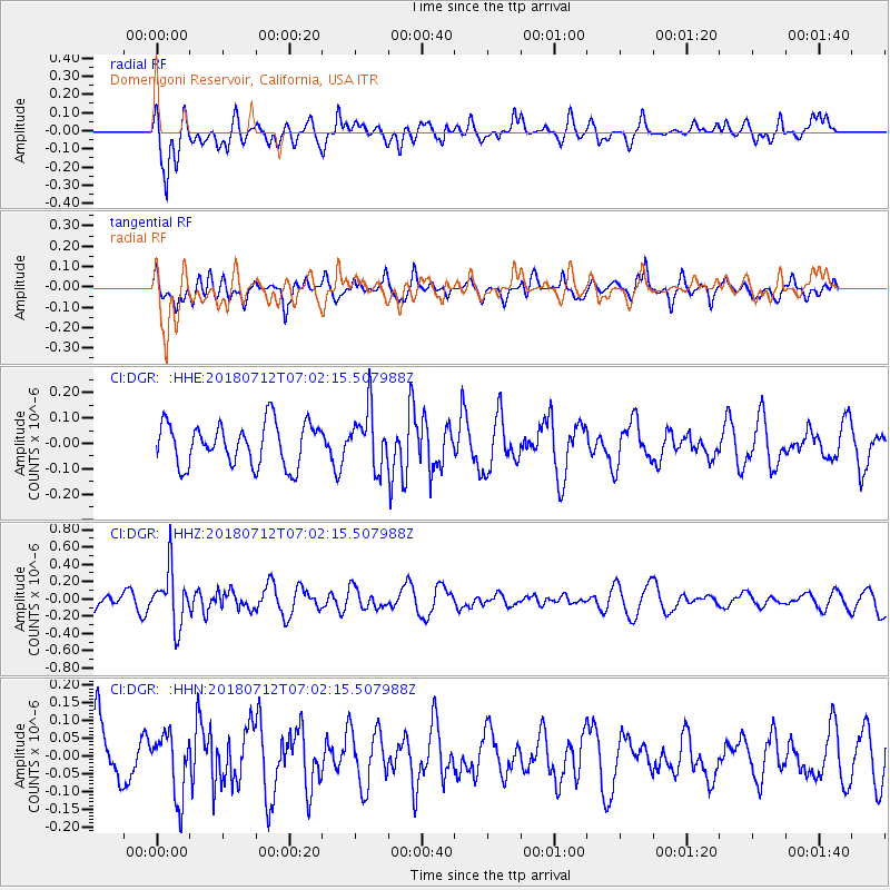
DGR Domenigoni Reservoir, California, USA - Earthquake Result Viewer
*The percent match for this event was below the threshold and hence no stack was calculated.
| Earthquake location: |
South Of Fiji Islands |
| Earthquake latitude/longitude: |
-23.3/-179.9 |
| Earthquake time(UTC): |
2018/07/12 (193) 06:51:21 GMT |
| Earthquake Depth: |
540 km |
| Earthquake Magnitude: |
5.5 Mww |
| Earthquake Catalog/Contributor: |
NEIC PDE/us |
|
| Network: |
CI Caltech Regional Seismic Network |
| Station: |
DGR Domenigoni Reservoir, California, USA |
| Lat/Lon: |
33.65 N/117.01 W |
| Elevation: |
609 m |
|
| Distance: |
82.4 deg |
| Az: |
48.512 deg |
| Baz: |
235.626 deg |
| Ray Param: |
$rayparam |
*The percent match for this event was below the threshold and hence was not used in the summary stack. |
|
| Radial Match: |
79.10372 % |
| Radial Bump: |
400 |
| Transverse Match: |
67.19428 % |
| Transverse Bump: |
400 |
| SOD ConfigId: |
13570011 |
| Insert Time: |
2019-04-30 13:32:04.012 +0000 |
| GWidth: |
2.5 |
| Max Bumps: |
400 |
| Tol: |
0.001 |
|
Signal To Noise
| Channel | StoN | STA | LTA |
| CI:DGR: :HHZ:20180712T07:02:15.507988Z | 3.3064766 | 3.1321744E-7 | 9.472846E-8 |
| CI:DGR: :HHN:20180712T07:02:15.507988Z | 0.9966292 | 8.876303E-8 | 8.906325E-8 |
| CI:DGR: :HHE:20180712T07:02:15.507988Z | 1.3555601 | 1.12612696E-7 | 8.307467E-8 |
| Arrivals |
| Ps | |
| PpPs | |
| PsPs/PpSs | |


