You are here: Home > Network List > CI - Caltech Regional Seismic Network Stations List
> Station MPP McPhearson Peak > Earthquake Result Viewer
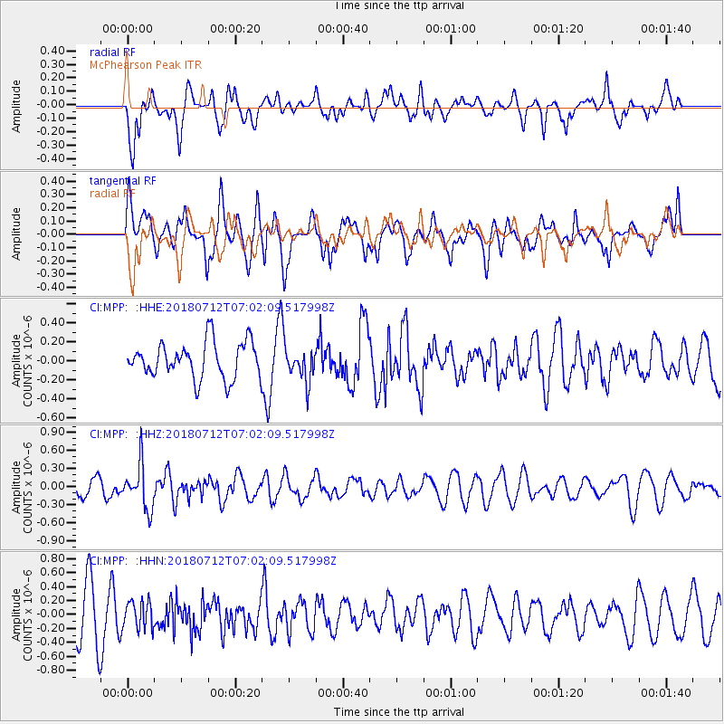
MPP McPhearson Peak - Earthquake Result Viewer
*The percent match for this event was below the threshold and hence no stack was calculated.
| Earthquake location: |
South Of Fiji Islands |
| Earthquake latitude/longitude: |
-23.3/-179.9 |
| Earthquake time(UTC): |
2018/07/12 (193) 06:51:21 GMT |
| Earthquake Depth: |
540 km |
| Earthquake Magnitude: |
5.5 Mww |
| Earthquake Catalog/Contributor: |
NEIC PDE/us |
|
| Network: |
CI Caltech Regional Seismic Network |
| Station: |
MPP McPhearson Peak |
| Lat/Lon: |
34.89 N/119.81 W |
| Elevation: |
1739 m |
|
| Distance: |
81.2 deg |
| Az: |
46.138 deg |
| Baz: |
233.717 deg |
| Ray Param: |
$rayparam |
*The percent match for this event was below the threshold and hence was not used in the summary stack. |
|
| Radial Match: |
52.83117 % |
| Radial Bump: |
400 |
| Transverse Match: |
51.914833 % |
| Transverse Bump: |
400 |
| SOD ConfigId: |
13570011 |
| Insert Time: |
2019-04-30 13:32:18.242 +0000 |
| GWidth: |
2.5 |
| Max Bumps: |
400 |
| Tol: |
0.001 |
|
Signal To Noise
| Channel | StoN | STA | LTA |
| CI:MPP: :HHZ:20180712T07:02:09.517998Z | 2.0548103 | 3.7304835E-7 | 1.8154881E-7 |
| CI:MPP: :HHN:20180712T07:02:09.517998Z | 0.67525744 | 1.9285223E-7 | 2.855981E-7 |
| CI:MPP: :HHE:20180712T07:02:09.517998Z | 0.90619963 | 1.7142222E-7 | 1.8916604E-7 |
| Arrivals |
| Ps | |
| PpPs | |
| PsPs/PpSs | |


