You are here: Home > Network List > CI - Caltech Regional Seismic Network Stations List
> Station MUR Murrieta > Earthquake Result Viewer
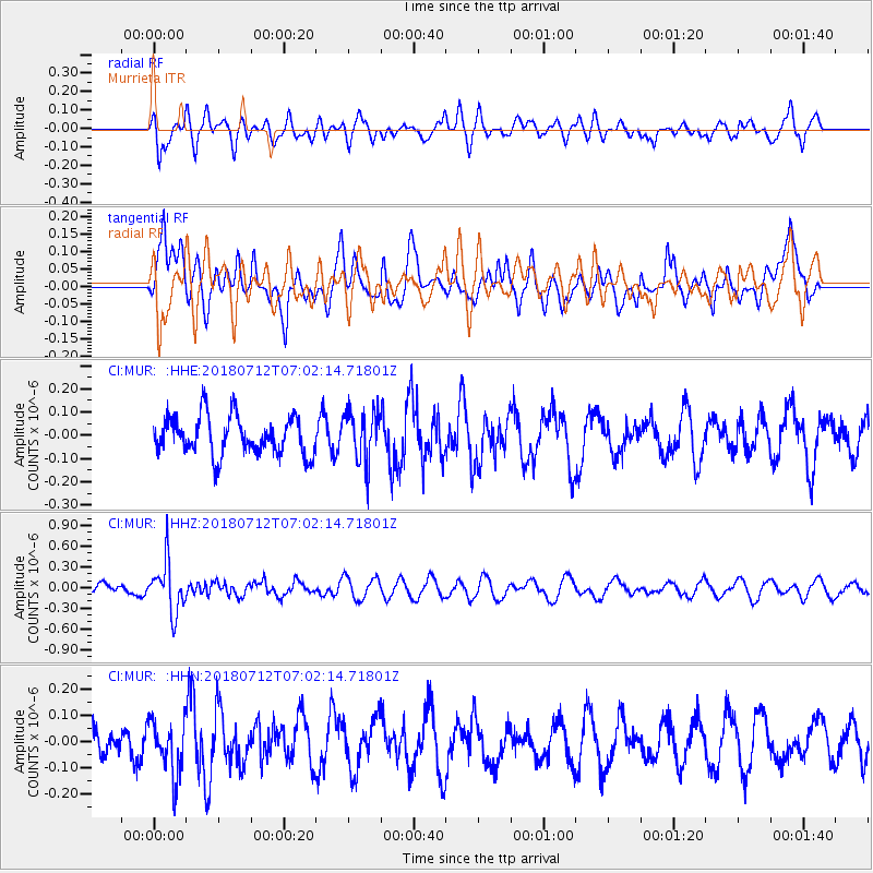
MUR Murrieta - Earthquake Result Viewer
*The percent match for this event was below the threshold and hence no stack was calculated.
| Earthquake location: |
South Of Fiji Islands |
| Earthquake latitude/longitude: |
-23.3/-179.9 |
| Earthquake time(UTC): |
2018/07/12 (193) 06:51:21 GMT |
| Earthquake Depth: |
540 km |
| Earthquake Magnitude: |
5.5 Mww |
| Earthquake Catalog/Contributor: |
NEIC PDE/us |
|
| Network: |
CI Caltech Regional Seismic Network |
| Station: |
MUR Murrieta |
| Lat/Lon: |
33.60 N/117.20 W |
| Elevation: |
562 m |
|
| Distance: |
82.3 deg |
| Az: |
48.465 deg |
| Baz: |
235.518 deg |
| Ray Param: |
$rayparam |
*The percent match for this event was below the threshold and hence was not used in the summary stack. |
|
| Radial Match: |
59.170837 % |
| Radial Bump: |
400 |
| Transverse Match: |
44.67551 % |
| Transverse Bump: |
400 |
| SOD ConfigId: |
13570011 |
| Insert Time: |
2019-04-30 13:32:19.544 +0000 |
| GWidth: |
2.5 |
| Max Bumps: |
400 |
| Tol: |
0.001 |
|
Signal To Noise
| Channel | StoN | STA | LTA |
| CI:MUR: :HHZ:20180712T07:02:14.71801Z | 3.1615472 | 3.6552362E-7 | 1.1561542E-7 |
| CI:MUR: :HHN:20180712T07:02:14.71801Z | 1.8985817 | 1.0535786E-7 | 5.5492933E-8 |
| CI:MUR: :HHE:20180712T07:02:14.71801Z | 1.3546836 | 1.1184909E-7 | 8.256473E-8 |
| Arrivals |
| Ps | |
| PpPs | |
| PsPs/PpSs | |


