You are here: Home > Network List > TA - USArray Transportable Network (new EarthScope stations) Stations List
> Station 221A Mesquite Ranch, Deming, NM, USA > Earthquake Result Viewer
221A Mesquite Ranch, Deming, NM, USA - Earthquake Result Viewer
| Earthquake location: |
Tonga Islands |
| Earthquake latitude/longitude: |
-21.9/-173.8 |
| Earthquake time(UTC): |
2008/10/19 (293) 05:10:33 GMT |
| Earthquake Depth: |
29 km |
| Earthquake Magnitude: |
6.8 MB, 7.0 MS, 6.9 MW, 6.9 MW |
| Earthquake Catalog/Contributor: |
WHDF/NEIC |
|
| Network: |
TA USArray Transportable Network (new EarthScope stations) |
| Station: |
221A Mesquite Ranch, Deming, NM, USA |
| Lat/Lon: |
32.01 N/107.78 W |
| Elevation: |
1277 m |
|
| Distance: |
82.8 deg |
| Az: |
51.491 deg |
| Baz: |
238.829 deg |
| Ray Param: |
0.04659382 |
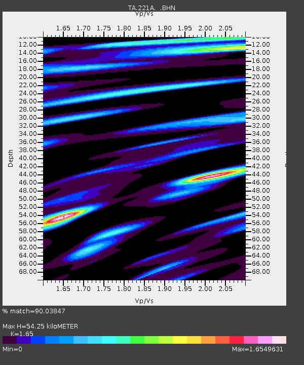
| Estimated Moho Depth: |
54.25 km |
| Estimated Crust Vp/Vs: |
1.65 |
| Assumed Crust Vp: |
6.502 km/s |
| Estimated Crust Vs: |
3.94 km/s |
| Estimated Crust Poisson's Ratio: |
0.21 |
|
| Radial Match: |
90.03847 % |
| Radial Bump: |
400 |
| Transverse Match: |
84.68618 % |
| Transverse Bump: |
400 |
| SOD ConfigId: |
2556 |
| Insert Time: |
2010-03-06 12:37:09.603 +0000 |
| GWidth: |
2.5 |
| Max Bumps: |
400 |
| Tol: |
0.001 |
|
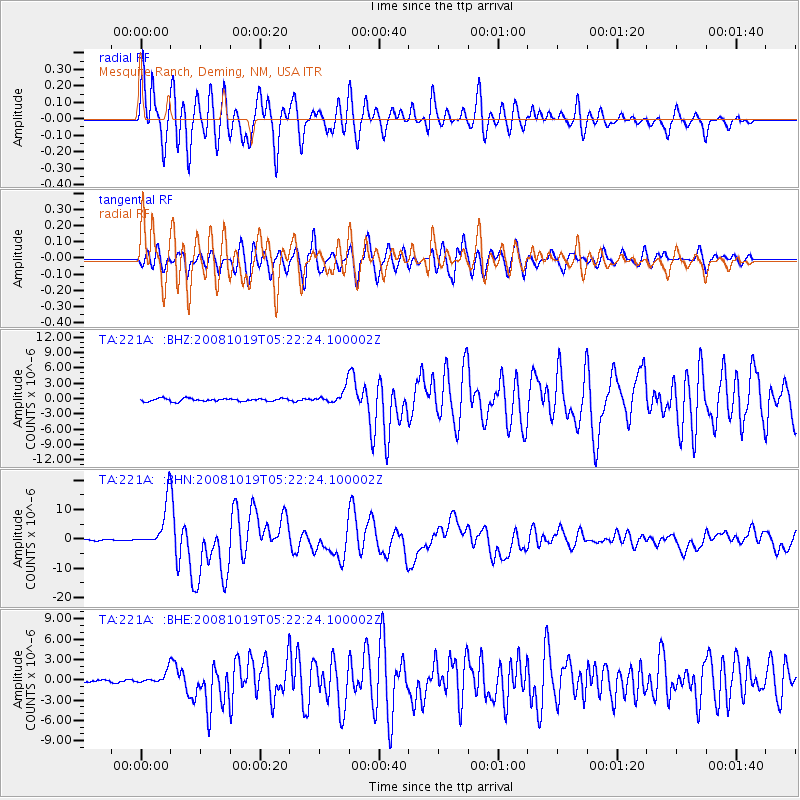
Signal To Noise
| Channel | StoN | STA | LTA |
| TA:221A: :BHN:20081019T05:22:24.100002Z | 41.524143 | 7.545714E-6 | 1.8171872E-7 |
| TA:221A: :BHE:20081019T05:22:24.100002Z | 3.7924118 | 8.849706E-7 | 2.3335298E-7 |
| TA:221A: :BHZ:20081019T05:22:24.100002Z | 5.185565 | 1.4916619E-6 | 2.876566E-7 |
| Arrivals |
| Ps | 5.6 SECOND |
| PpPs | 21 SECOND |
| PsPs/PpSs | 27 SECOND |


