You are here: Home > Network List > TA - USArray Transportable Network (new EarthScope stations) Stations List
> Station J26L Joseph Creek, AK, USA > Earthquake Result Viewer
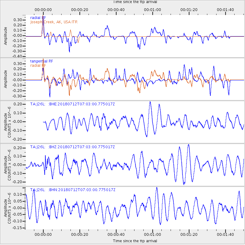
J26L Joseph Creek, AK, USA - Earthquake Result Viewer
*The percent match for this event was below the threshold and hence no stack was calculated.
| Earthquake location: |
South Of Fiji Islands |
| Earthquake latitude/longitude: |
-23.3/-179.9 |
| Earthquake time(UTC): |
2018/07/12 (193) 06:51:21 GMT |
| Earthquake Depth: |
540 km |
| Earthquake Magnitude: |
5.5 Mww |
| Earthquake Catalog/Contributor: |
NEIC PDE/us |
|
| Network: |
TA USArray Transportable Network (new EarthScope stations) |
| Station: |
J26L Joseph Creek, AK, USA |
| Lat/Lon: |
64.50 N/143.56 W |
| Elevation: |
1144 m |
|
| Distance: |
92.0 deg |
| Az: |
14.872 deg |
| Baz: |
213.024 deg |
| Ray Param: |
$rayparam |
*The percent match for this event was below the threshold and hence was not used in the summary stack. |
|
| Radial Match: |
48.471397 % |
| Radial Bump: |
400 |
| Transverse Match: |
52.790203 % |
| Transverse Bump: |
400 |
| SOD ConfigId: |
13570011 |
| Insert Time: |
2019-04-30 13:35:11.386 +0000 |
| GWidth: |
2.5 |
| Max Bumps: |
400 |
| Tol: |
0.001 |
|
Signal To Noise
| Channel | StoN | STA | LTA |
| TA:J26L: :BHZ:20180712T07:03:00.775017Z | 1.3894569 | 5.4619257E-8 | 3.930979E-8 |
| TA:J26L: :BHN:20180712T07:03:00.775017Z | 0.6098695 | 3.9594113E-8 | 6.492227E-8 |
| TA:J26L: :BHE:20180712T07:03:00.775017Z | 1.155595 | 6.212507E-8 | 5.3760246E-8 |
| Arrivals |
| Ps | |
| PpPs | |
| PsPs/PpSs | |


