You are here: Home > Network List > TA - USArray Transportable Network (new EarthScope stations) Stations List
> Station P17K Kvichak River, AK, USA > Earthquake Result Viewer
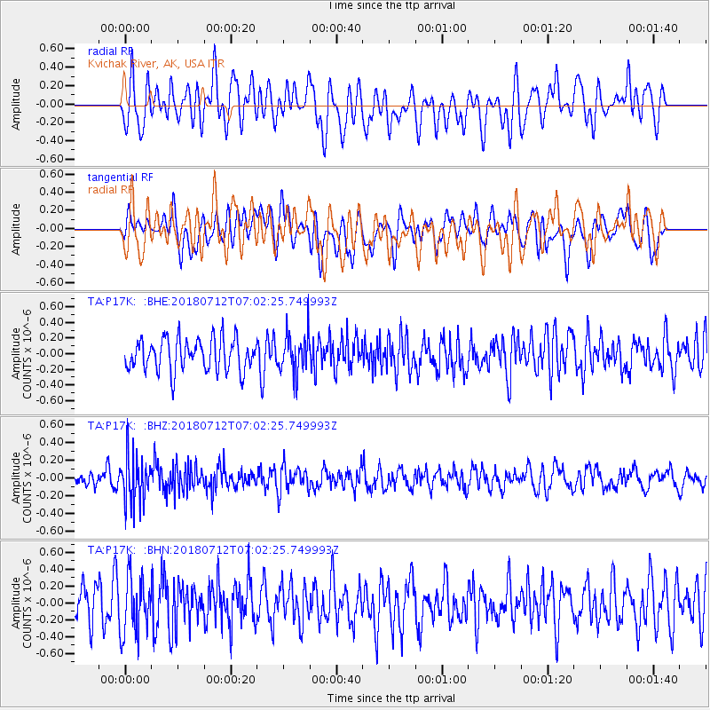
P17K Kvichak River, AK, USA - Earthquake Result Viewer
*The percent match for this event was below the threshold and hence no stack was calculated.
| Earthquake location: |
South Of Fiji Islands |
| Earthquake latitude/longitude: |
-23.3/-179.9 |
| Earthquake time(UTC): |
2018/07/12 (193) 06:51:21 GMT |
| Earthquake Depth: |
540 km |
| Earthquake Magnitude: |
5.5 Mww |
| Earthquake Catalog/Contributor: |
NEIC PDE/us |
|
| Network: |
TA USArray Transportable Network (new EarthScope stations) |
| Station: |
P17K Kvichak River, AK, USA |
| Lat/Lon: |
59.20 N/156.44 W |
| Elevation: |
91 m |
|
| Distance: |
84.5 deg |
| Az: |
11.882 deg |
| Baz: |
201.574 deg |
| Ray Param: |
$rayparam |
*The percent match for this event was below the threshold and hence was not used in the summary stack. |
|
| Radial Match: |
51.94552 % |
| Radial Bump: |
400 |
| Transverse Match: |
47.209106 % |
| Transverse Bump: |
400 |
| SOD ConfigId: |
13570011 |
| Insert Time: |
2019-04-30 13:35:24.080 +0000 |
| GWidth: |
2.5 |
| Max Bumps: |
400 |
| Tol: |
0.001 |
|
Signal To Noise
| Channel | StoN | STA | LTA |
| TA:P17K: :BHZ:20180712T07:02:25.749993Z | 3.0538206 | 2.6435757E-7 | 8.656618E-8 |
| TA:P17K: :BHN:20180712T07:02:25.749993Z | 1.4321345 | 3.4573281E-7 | 2.4141087E-7 |
| TA:P17K: :BHE:20180712T07:02:25.749993Z | 1.262784 | 2.5793528E-7 | 2.0425922E-7 |
| Arrivals |
| Ps | |
| PpPs | |
| PsPs/PpSs | |


