You are here: Home > Network List > UW - Pacific Northwest Regional Seismic Network Stations List
> Station LEBA Lebam, WA, USA > Earthquake Result Viewer
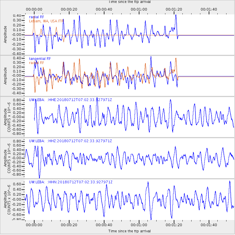
LEBA Lebam, WA, USA - Earthquake Result Viewer
*The percent match for this event was below the threshold and hence no stack was calculated.
| Earthquake location: |
South Of Fiji Islands |
| Earthquake latitude/longitude: |
-23.3/-179.9 |
| Earthquake time(UTC): |
2018/07/12 (193) 06:51:21 GMT |
| Earthquake Depth: |
540 km |
| Earthquake Magnitude: |
5.5 Mww |
| Earthquake Catalog/Contributor: |
NEIC PDE/us |
|
| Network: |
UW Pacific Northwest Regional Seismic Network |
| Station: |
LEBA Lebam, WA, USA |
| Lat/Lon: |
46.55 N/123.56 W |
| Elevation: |
73 m |
|
| Distance: |
86.2 deg |
| Az: |
35.154 deg |
| Baz: |
230.06 deg |
| Ray Param: |
$rayparam |
*The percent match for this event was below the threshold and hence was not used in the summary stack. |
|
| Radial Match: |
53.513615 % |
| Radial Bump: |
355 |
| Transverse Match: |
62.696957 % |
| Transverse Bump: |
400 |
| SOD ConfigId: |
13570011 |
| Insert Time: |
2019-04-30 13:36:11.018 +0000 |
| GWidth: |
2.5 |
| Max Bumps: |
400 |
| Tol: |
0.001 |
|
Signal To Noise
| Channel | StoN | STA | LTA |
| UW:LEBA: :HHZ:20180712T07:02:33.927971Z | 2.5442321 | 4.8375864E-7 | 1.9013936E-7 |
| UW:LEBA: :HHN:20180712T07:02:33.927971Z | 0.9110052 | 2.2436289E-7 | 2.462806E-7 |
| UW:LEBA: :HHE:20180712T07:02:33.927971Z | 1.1043894 | 3.3221153E-7 | 3.0081014E-7 |
| Arrivals |
| Ps | |
| PpPs | |
| PsPs/PpSs | |


