You are here: Home > Network List > UW - Pacific Northwest Regional Seismic Network Stations List
> Station UMAT Pilot Rock, OR, USA > Earthquake Result Viewer
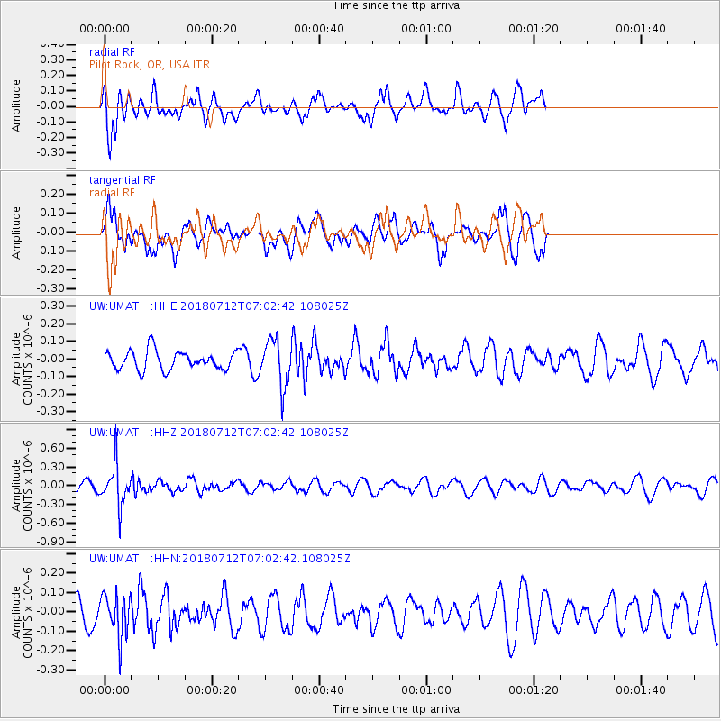
UMAT Pilot Rock, OR, USA - Earthquake Result Viewer
*The percent match for this event was below the threshold and hence no stack was calculated.
| Earthquake location: |
South Of Fiji Islands |
| Earthquake latitude/longitude: |
-23.3/-179.9 |
| Earthquake time(UTC): |
2018/07/12 (193) 06:51:21 GMT |
| Earthquake Depth: |
540 km |
| Earthquake Magnitude: |
5.5 Mww |
| Earthquake Catalog/Contributor: |
NEIC PDE/us |
|
| Network: |
UW Pacific Northwest Regional Seismic Network |
| Station: |
UMAT Pilot Rock, OR, USA |
| Lat/Lon: |
45.29 N/118.96 W |
| Elevation: |
1318 m |
|
| Distance: |
87.9 deg |
| Az: |
38.132 deg |
| Baz: |
233.509 deg |
| Ray Param: |
$rayparam |
*The percent match for this event was below the threshold and hence was not used in the summary stack. |
|
| Radial Match: |
64.14725 % |
| Radial Bump: |
400 |
| Transverse Match: |
62.787197 % |
| Transverse Bump: |
359 |
| SOD ConfigId: |
13570011 |
| Insert Time: |
2019-04-30 13:36:21.268 +0000 |
| GWidth: |
2.5 |
| Max Bumps: |
400 |
| Tol: |
0.001 |
|
Signal To Noise
| Channel | StoN | STA | LTA |
| UW:UMAT: :HHZ:20180712T07:02:42.108025Z | 5.181785 | 3.2542755E-7 | 6.28022E-8 |
| UW:UMAT: :HHN:20180712T07:02:42.108025Z | 1.6692117 | 1.1019204E-7 | 6.601442E-8 |
| UW:UMAT: :HHE:20180712T07:02:42.108025Z | 2.5172474 | 1.3491305E-7 | 5.3595464E-8 |
| Arrivals |
| Ps | |
| PpPs | |
| PsPs/PpSs | |


