You are here: Home > Network List > II - Global Seismograph Network (GSN - IRIS/IDA) Stations List
> Station MBAR Mbarara, Uganda > Earthquake Result Viewer
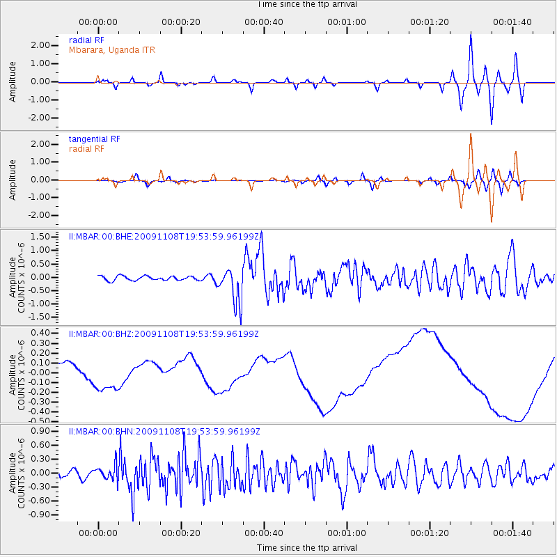
MBAR Mbarara, Uganda - Earthquake Result Viewer
*The percent match for this event was below the threshold and hence no stack was calculated.
| Earthquake location: |
Sumbawa Region, Indonesia |
| Earthquake latitude/longitude: |
-8.2/118.6 |
| Earthquake time(UTC): |
2009/11/08 (312) 19:41:43 GMT |
| Earthquake Depth: |
18 km |
| Earthquake Magnitude: |
6.3 MB, 6.5 MS, 6.6 MW, 6.5 MW |
| Earthquake Catalog/Contributor: |
WHDF/NEIC |
|
| Network: |
II Global Seismograph Network (GSN - IRIS/IDA) |
| Station: |
MBAR Mbarara, Uganda |
| Lat/Lon: |
0.60 S/30.74 E |
| Elevation: |
1390 m |
|
| Distance: |
87.8 deg |
| Az: |
269.707 deg |
| Baz: |
98.136 deg |
| Ray Param: |
$rayparam |
*The percent match for this event was below the threshold and hence was not used in the summary stack. |
|
| Radial Match: |
43.23086 % |
| Radial Bump: |
400 |
| Transverse Match: |
23.083776 % |
| Transverse Bump: |
400 |
| SOD ConfigId: |
1 |
| Insert Time: |
2010-02-19 01:06:51.546 +0000 |
| GWidth: |
2.5 |
| Max Bumps: |
400 |
| Tol: |
0.001 |
|
Signal To Noise
| Channel | StoN | STA | LTA |
| II:MBAR:00:BHZ:20091108T19:53:59.96199Z | 2.8831425 | 1.957502E-7 | 6.789474E-8 |
| II:MBAR:00:BHN:20091108T19:53:59.96199Z | 2.1883843 | 1.5577783E-7 | 7.118395E-8 |
| II:MBAR:00:BHE:20091108T19:53:59.96199Z | 8.668656 | 7.005789E-7 | 8.081747E-8 |
| Arrivals |
| Ps | |
| PpPs | |
| PsPs/PpSs | |


