You are here: Home > Network List > CI - Caltech Regional Seismic Network Stations List
> Station MPP McPhearson Peak > Earthquake Result Viewer
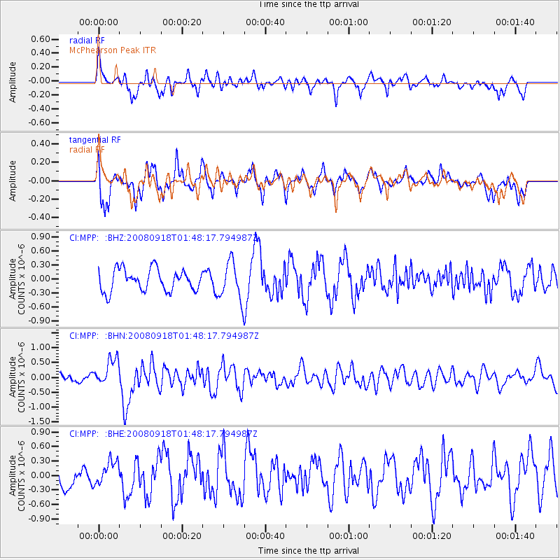
MPP McPhearson Peak - Earthquake Result Viewer
*The percent match for this event was below the threshold and hence no stack was calculated.
| Earthquake location: |
Central East Pacific Rise |
| Earthquake latitude/longitude: |
-4.6/-106.0 |
| Earthquake time(UTC): |
2008/09/18 (262) 01:41:02 GMT |
| Earthquake Depth: |
10 km |
| Earthquake Magnitude: |
5.5 MB, 5.7 MS, 6.0 MW, 6.0 MW |
| Earthquake Catalog/Contributor: |
WHDF/NEIC |
|
| Network: |
CI Caltech Regional Seismic Network |
| Station: |
MPP McPhearson Peak |
| Lat/Lon: |
34.89 N/119.81 W |
| Elevation: |
1739 m |
|
| Distance: |
41.3 deg |
| Az: |
342.711 deg |
| Baz: |
158.875 deg |
| Ray Param: |
$rayparam |
*The percent match for this event was below the threshold and hence was not used in the summary stack. |
|
| Radial Match: |
67.80635 % |
| Radial Bump: |
400 |
| Transverse Match: |
77.36942 % |
| Transverse Bump: |
400 |
| SOD ConfigId: |
2504 |
| Insert Time: |
2010-02-26 02:04:54.056 +0000 |
| GWidth: |
2.5 |
| Max Bumps: |
400 |
| Tol: |
0.001 |
|
Signal To Noise
| Channel | StoN | STA | LTA |
| CI:MPP: :BHN:20080918T01:48:17.794987Z | 3.0303085 | 4.6349473E-7 | 1.5295299E-7 |
| CI:MPP: :BHE:20080918T01:48:17.794987Z | 1.0834343 | 2.630282E-7 | 2.4277264E-7 |
| CI:MPP: :BHZ:20080918T01:48:17.794987Z | 1.8236327 | 4.2242553E-7 | 2.316396E-7 |
| Arrivals |
| Ps | |
| PpPs | |
| PsPs/PpSs | |


