You are here: Home > Network List > TA - USArray Transportable Network (new EarthScope stations) Stations List
> Station F26K Sheenjek River, AK, USA > Earthquake Result Viewer
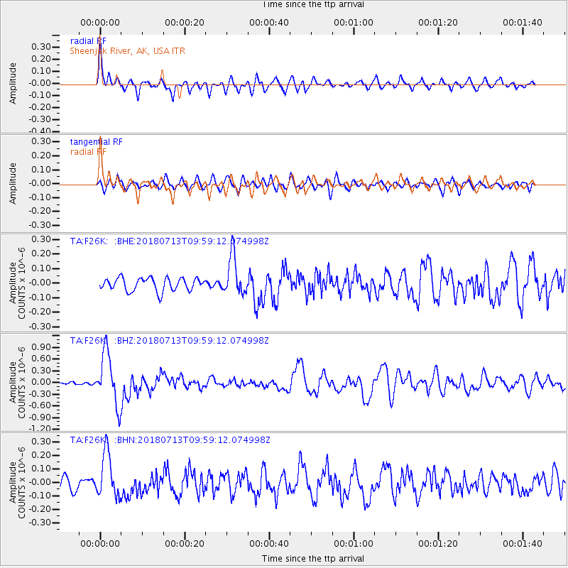
F26K Sheenjek River, AK, USA - Earthquake Result Viewer
*The percent match for this event was below the threshold and hence no stack was calculated.
| Earthquake location: |
Vanuatu Islands |
| Earthquake latitude/longitude: |
-18.9/169.0 |
| Earthquake time(UTC): |
2018/07/13 (194) 09:46:49 GMT |
| Earthquake Depth: |
169 km |
| Earthquake Magnitude: |
6.4 Mww |
| Earthquake Catalog/Contributor: |
NEIC PDE/us |
|
| Network: |
TA USArray Transportable Network (new EarthScope stations) |
| Station: |
F26K Sheenjek River, AK, USA |
| Lat/Lon: |
67.69 N/144.15 W |
| Elevation: |
683 m |
|
| Distance: |
92.9 deg |
| Az: |
16.187 deg |
| Baz: |
223.731 deg |
| Ray Param: |
$rayparam |
*The percent match for this event was below the threshold and hence was not used in the summary stack. |
|
| Radial Match: |
78.58843 % |
| Radial Bump: |
400 |
| Transverse Match: |
50.69858 % |
| Transverse Bump: |
400 |
| SOD ConfigId: |
13570011 |
| Insert Time: |
2019-04-30 13:44:36.205 +0000 |
| GWidth: |
2.5 |
| Max Bumps: |
400 |
| Tol: |
0.001 |
|
Signal To Noise
| Channel | StoN | STA | LTA |
| TA:F26K: :BHZ:20180713T09:59:12.074998Z | 15.606964 | 6.80827E-7 | 4.362328E-8 |
| TA:F26K: :BHN:20180713T09:59:12.074998Z | 3.1433978 | 1.7004481E-7 | 5.4095864E-8 |
| TA:F26K: :BHE:20180713T09:59:12.074998Z | 3.1098535 | 1.3762511E-7 | 4.425453E-8 |
| Arrivals |
| Ps | |
| PpPs | |
| PsPs/PpSs | |


