You are here: Home > Network List > CI - Caltech Regional Seismic Network Stations List
> Station MPP McPhearson Peak > Earthquake Result Viewer
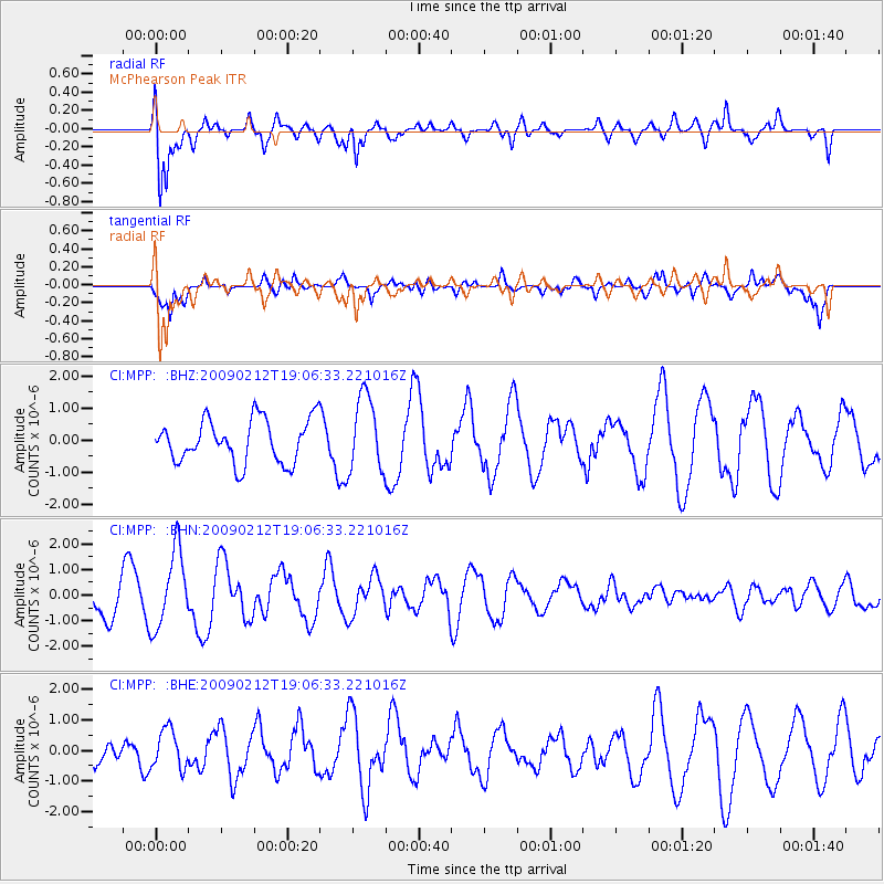
MPP McPhearson Peak - Earthquake Result Viewer
*The percent match for this event was below the threshold and hence no stack was calculated.
| Earthquake location: |
Kermadec Islands Region |
| Earthquake latitude/longitude: |
-31.2/-178.1 |
| Earthquake time(UTC): |
2009/02/12 (043) 18:54:28 GMT |
| Earthquake Depth: |
24 km |
| Earthquake Magnitude: |
5.6 MB, 5.6 MS, 5.9 MW, 5.8 MW |
| Earthquake Catalog/Contributor: |
WHDF/NEIC |
|
| Network: |
CI Caltech Regional Seismic Network |
| Station: |
MPP McPhearson Peak |
| Lat/Lon: |
34.89 N/119.81 W |
| Elevation: |
1739 m |
|
| Distance: |
85.6 deg |
| Az: |
44.543 deg |
| Baz: |
226.964 deg |
| Ray Param: |
$rayparam |
*The percent match for this event was below the threshold and hence was not used in the summary stack. |
|
| Radial Match: |
85.13058 % |
| Radial Bump: |
400 |
| Transverse Match: |
60.70125 % |
| Transverse Bump: |
400 |
| SOD ConfigId: |
2658 |
| Insert Time: |
2010-02-26 02:04:54.630 +0000 |
| GWidth: |
2.5 |
| Max Bumps: |
400 |
| Tol: |
0.001 |
|
Signal To Noise
| Channel | StoN | STA | LTA |
| CI:MPP: :BHN:20090212T19:06:33.221016Z | 2.9283144 | 1.4954346E-6 | 5.1068105E-7 |
| CI:MPP: :BHE:20090212T19:06:33.221016Z | 0.7910056 | 6.37731E-7 | 8.062281E-7 |
| CI:MPP: :BHZ:20090212T19:06:33.221016Z | 1.752268 | 1.1810719E-6 | 6.740247E-7 |
| Arrivals |
| Ps | |
| PpPs | |
| PsPs/PpSs | |


